
MyTopo
Cathedral Point Montana US Topo Map
Couldn't load pickup availability
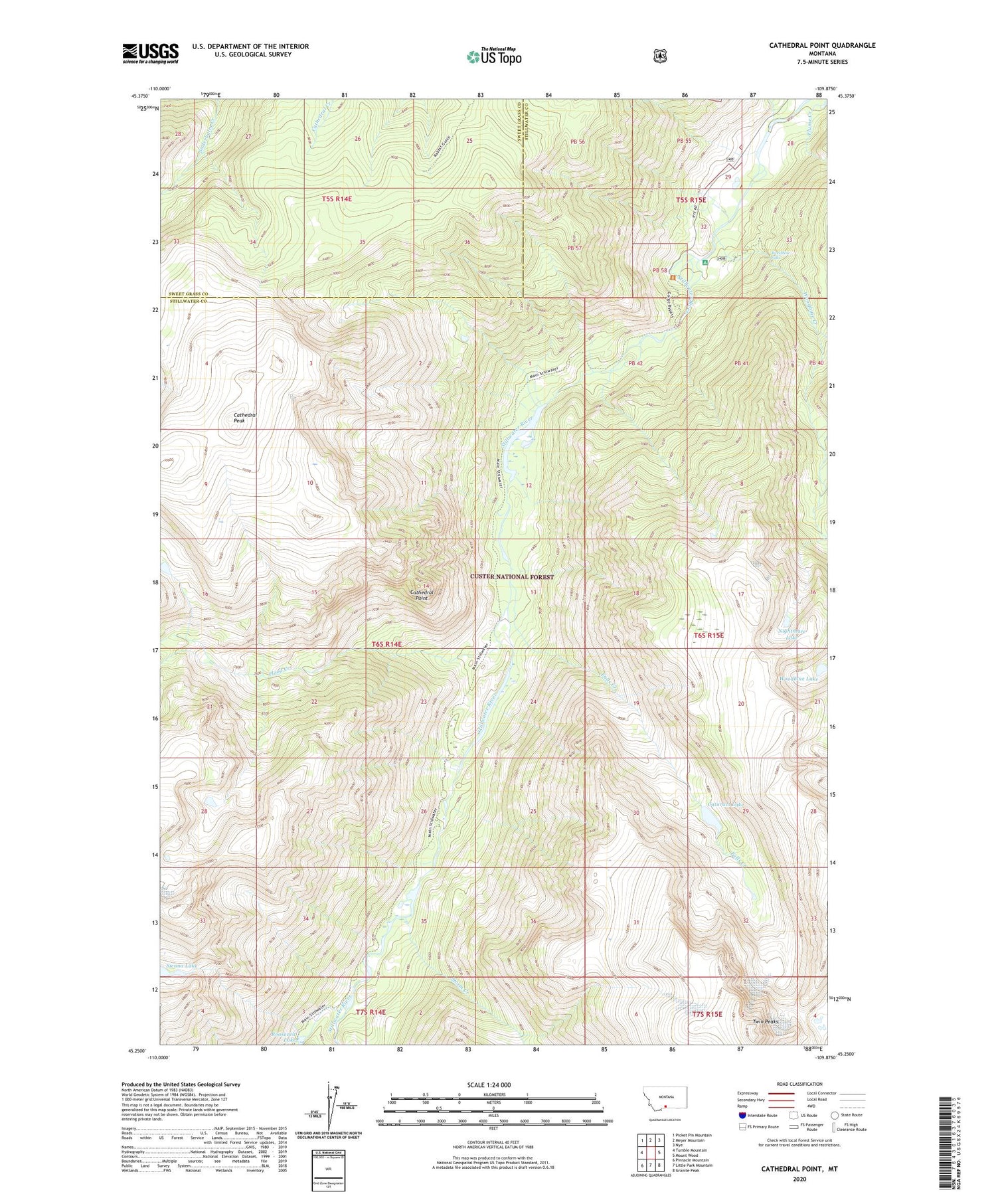
2020 topographic map quadrangle Cathedral Point in the state of Montana. Scale: 1:24000. Based on the newly updated USGS 7.5' US Topo map series, this map is in the following counties: Stillwater, Sweet Grass. The map contains contour data, water features, and other items you are used to seeing on USGS maps, but also has updated roads and other features. This is the next generation of topographic maps. Printed on high-quality waterproof paper with UV fade-resistant inks.
Quads adjacent to this one:
West: Tumble Mountain
Northwest: Picket Pin Mountain
North: Meyer Mountain
Northeast: Nye
East: Mount Wood
Southeast: Granite Peak
South: Little Park Mountain
Southwest: Pinnacle Mountain
Contains the following named places: 05S15E32DBCA01 Well, 05S15E32DBDD01 Well, 59061, Beartooth Ranch, Cataract Lake, Cathedral Peak, Cathedral Point, Dayton Cabin, Falls Creek, Flood Creek, Flume Creek, Mouat, Nightmare Lake, Roosevelt Lake, Sienna Lake, Sioux Charley Lake, Storm Creek, Twin Peaks, Woodbine Campground, Woodbine Creek, Woodbine Falls, Woodbine Lake


