MyTopo
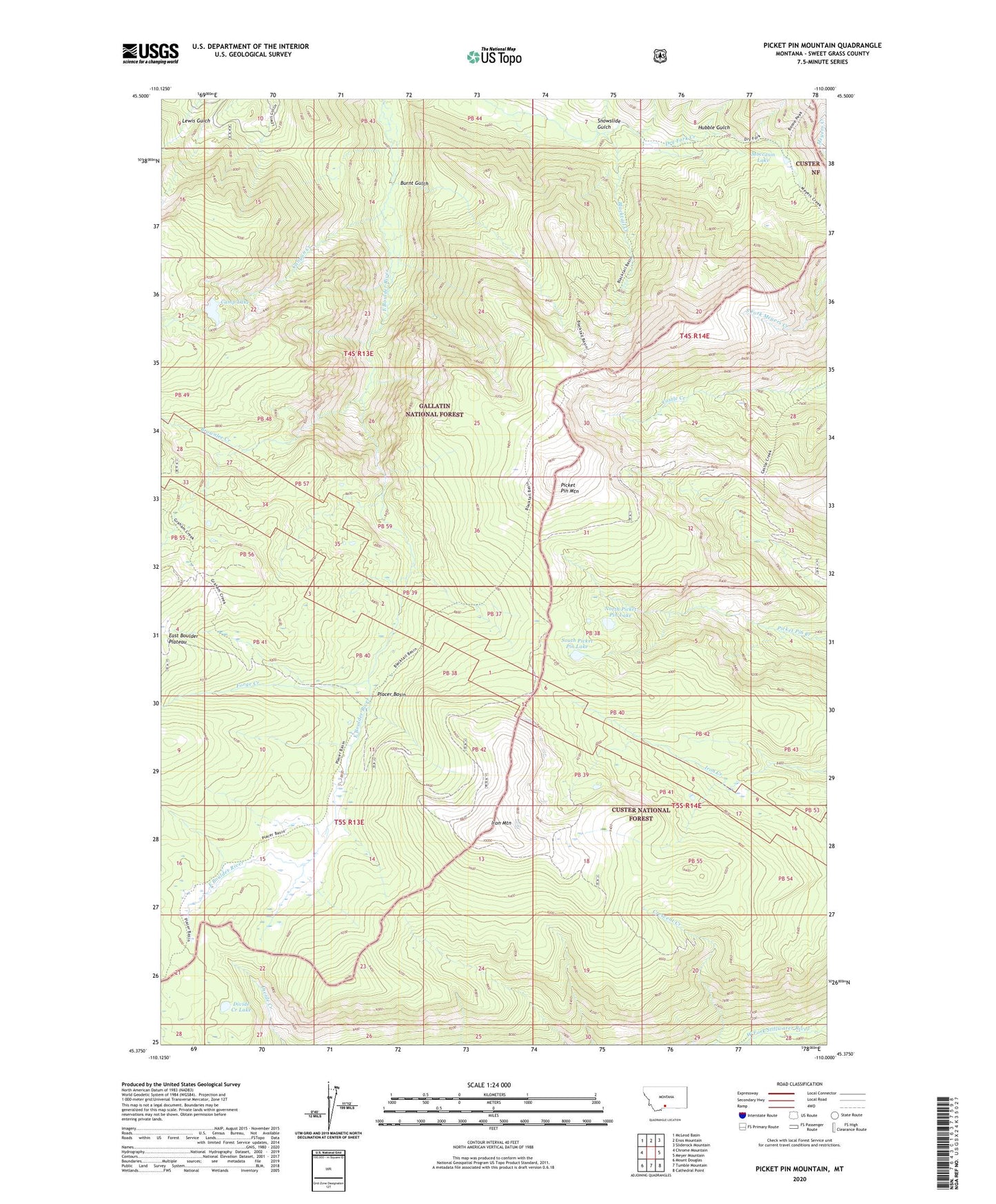
Picket Pin Mountain Montana US Topo Map
Couldn't load pickup availability
Also explore the Picket Pin Mountain Forest Service Topo of this same quad for updated USFS data
2024 topographic map quadrangle Picket Pin Mountain in the state of Montana. Scale: 1:24000. Based on the newly updated USGS 7.5' US Topo map series, this map is in the following counties: Sweet Grass. The map contains contour data, water features, and other items you are used to seeing on USGS maps, but also has updated roads and other features. This is the next generation of topographic maps. Printed on high-quality waterproof paper with UV fade-resistant inks.
Quads adjacent to this one:
West: Chrome Mountain
Northwest: McLeod Basin
North: Enos Mountain
Northeast: Sliderock Mountain
East: Meyer Mountain
Southeast: Cathedral Point
South: Tumble Mountain
Southwest: Mount Douglas
This map covers the same area as the classic USGS quad with code o45110d1.
Contains the following named places: 04S14E07CDAD01 Well, 04S14E07CDAD02 Well, 04S14E07CDAD03 Well, 04S14E07CDDA01 Well, 04S14E07CDDB01 Well, Blacktail Creek, Brownlee Creek, Burnt Gulch, Camp Lake, Canyon Creek, Divide Creek Lake, East Boulder Plateau, Forge Creek, Hubble Gulch, Iron Mountain, Moccasin Lake, North Picket Pin Lake, Picket Pin Mountain, Placer Basin, Snowslide Gulch, South Picket Pin Lake