MyTopo
Wolf Point NE Montana US Topo Map
Couldn't load pickup availability
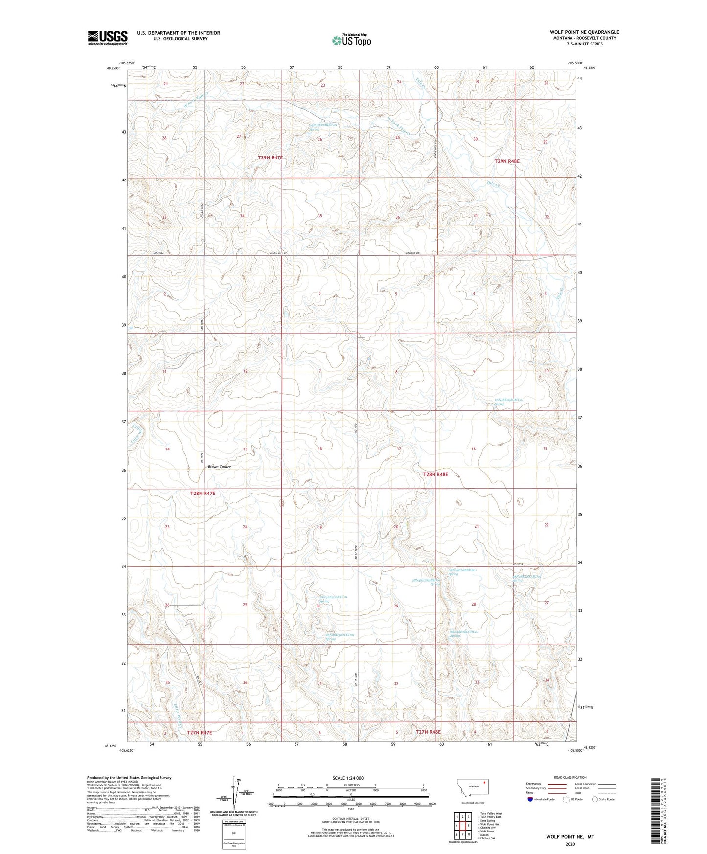
2024 topographic map quadrangle Wolf Point NE in the state of Montana. Scale: 1:24000. Based on the newly updated USGS 7.5' US Topo map series, this map is in the following counties: Roosevelt. The map contains contour data, water features, and other items you are used to seeing on USGS maps, but also has updated roads and other features. This is the next generation of topographic maps. Printed on high-quality waterproof paper with UV fade-resistant inks.
Quads adjacent to this one:
West: Wolf Point NW
Northwest: Tule Valley West
North: Tule Valley East
Northeast: Sims Spring
East: Chelsea NW
Southeast: Chelsea SW
South: Macon
Southwest: Wolf Point
This map covers the same area as the classic USGS quad with code o48105b5.
Contains the following named places: 28N47E02CBBD01 Well, 28N47E26DBAD01 Well, 28N47E26DBAD02 Well, 28N47E35DCBA01 Well, 28N48E03AC__01 Well, 28N48E03AC__02 Well, 28N48E03DA__01 Well, 28N48E03DD__01 Well, 28N48E03DD__02 Well, 28N48E03DD__03 Well, 28N48E03DDBB01 Well, 28N48E04AACC01 Well, 28N48E08BB__01 Well, 28N48E08BBBA01 Well, 28N48E08BCCC01 Well, 28N48E09DDCC01 Spring, 28N48E17BA__01 Well, 28N48E18AD__01 Well, 28N48E18AD__02 Well, 28N48E18AD__03 Well, 28N48E20AA__01 Well, 28N48E21CD__01 Well, 28N48E21DD__01 Well, 28N48E28AADD01 Spring, 28N48E28BABB01 Well, 28N48E28BABC01 Well, 28N48E28BBBD01 Spring, 28N48E28BBDB01 Spring, 28N48E28CCDC01 Spring, 28N48E30ACCC01 Spring, 28N48E30AD__01 Well, 28N48E30DCCD01 Spring, 28N48E31AB__01 Well, 28N48E31AB__02 Well, 28N48E32BC__01 Well, 28N48E32BC__02 Well, 28N48E34AC__01 Well, 29N47E26ACBA01 Well, 29N47E26BDCA01 Spring, 29N47E28AAAA01 Well, Marquardt School, West Fork Tule Creek