
MyTopo
Clancy Montana US Topo Map
Couldn't load pickup availability
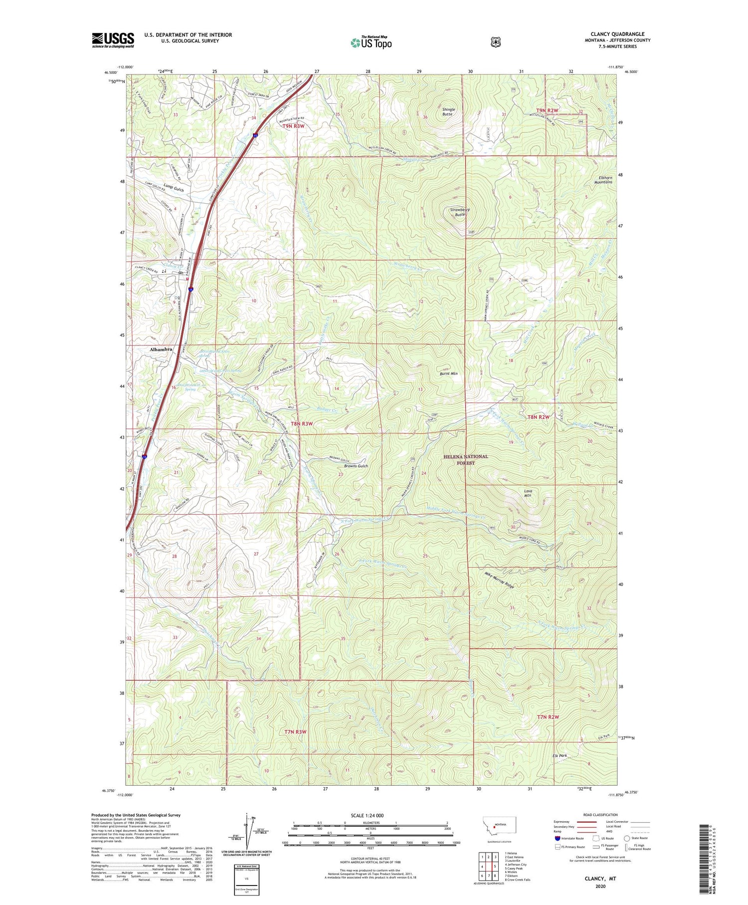
2020 topographic map quadrangle Clancy in the state of Montana. Scale: 1:24000. Based on the newly updated USGS 7.5' US Topo map series, this map is in the following counties: Jefferson. The map contains contour data, water features, and other items you are used to seeing on USGS maps, but also has updated roads and other features. This is the next generation of topographic maps. Printed on high-quality waterproof paper with UV fade-resistant inks.
Quads adjacent to this one:
West: Jefferson City
Northwest: Helena
North: East Helena
Northeast: Louisville
East: Casey Peak
Southeast: Crow Creek Falls
South: Elkhorn
Southwest: Wickes
Contains the following named places: 08N03W16AAB_01 Well, 08N03W16AAC_01 Well, 08N03W16ABB_01 Well, 08N03W16ACA_01 Spring, 08N03W16ACAA01 Spring, 08N03W16ACBC01 Well, 08N03W16ACD_01 Spring, 08N03W16ADB_01 Well, 08N03W16ADD_01 Well, 08N03W16BDA_01 Well, 08N03W22ACA_01 Well, 59634, Alhambra, Alhambra Hot Springs Mine, Alhambra Post Office, Alhambra RV Park, Argonaut Mine, B and G Mine, Badger Creek, Browns Gulch, Burnt Mountain, Champion Mine, Clancy, Clancy Creek, Clancy Elementary School, Clancy Post Office, Clancy United Methodist Church, Clancy Volunteer Fire Company Station 1, Dutchman Creek, Eagles Nest Mine, Elk Park, Elkhorn Search and Rescue, Forest Park Mine, Hartford, Haystack Creek, Hillbrook Nursing Home, Hogan Creek, Kains, Lava Mountain, Lewiston, Lump, Lump Gulch, Lump Post Office, McClellan Ranger Station, Mid Fork Warm Springs Mine, Middle Fork Warm Springs Creek, Mike Murray Ridge, Mill Creek, NE NE Section 18 Mine, New Haven, North Fork Warm Springs Creek, NW SW Section 24 Mine, Rattlesnake Creek, Saint John Mission, Scott Reservoir, Shingle Butte, Shingle Creek, South Fork Warm Springs Creek, Strawberry Butte, Strawberry Creek, Sunnyside, Wall 2 Mine, Warm Springs Creek, Westover Gulch


