MyTopo
Cole Montana US Topo Map
Couldn't load pickup availability
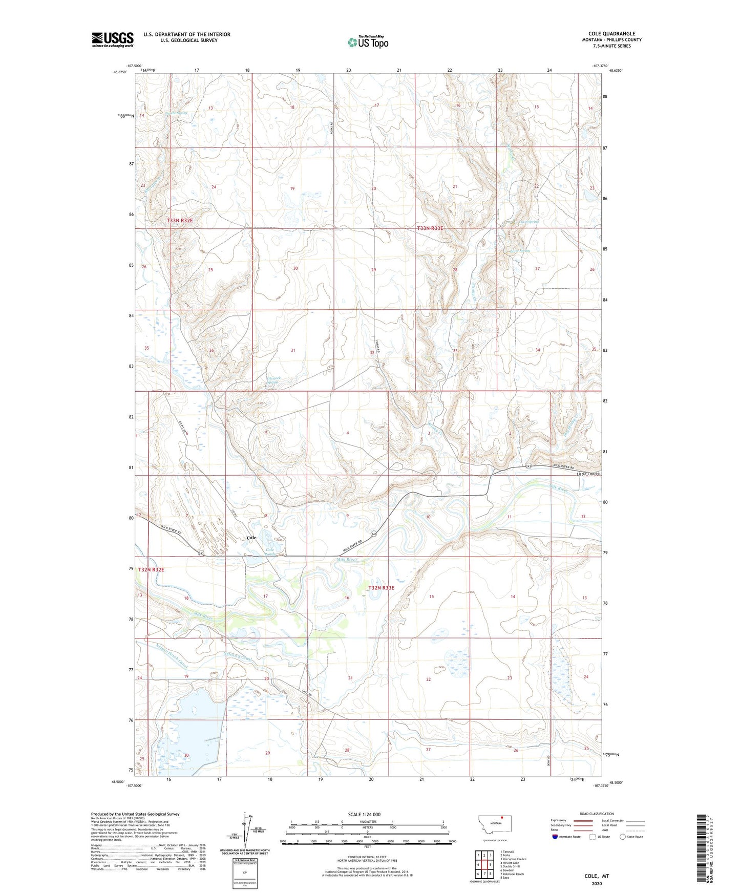
2024 topographic map quadrangle Cole in the state of Montana. Scale: 1:24000. Based on the newly updated USGS 7.5' US Topo map series, this map is in the following counties: Phillips. The map contains contour data, water features, and other items you are used to seeing on USGS maps, but also has updated roads and other features. This is the next generation of topographic maps. Printed on high-quality waterproof paper with UV fade-resistant inks.
Quads adjacent to this one:
West: Hewitt Lake
Northwest: Tattnall
North: Forks
Northeast: Porcupine Coulee
East: Double S Hill
Southeast: Saco
South: Robinson Ranch
Southwest: Bowdoin
This map covers the same area as the classic USGS quad with code o48107e4.
Contains the following named places: 32N33E16BA__01 Well, 32N33E17DAD_01 Well, 32N33E25BCB_01 Well, 59261, Akins School, Bache School, Bellman School, Birums Ranch, Busche Spring, Carter Lake, Cole, Cole Ponds, Cole Ponds Fishing Access Site, Cole Post Office, Cole School, Dry Stinky Creek, Frenchman Irrigation Company Number 1 Dam, Glascock Spring, Hedger's Ranch, Hill Top School, Huntley School, Latham School, Little Coulee, Luvel Spring, Martin's Ranch, Mills' Ranch, Nelson South Canal, New Minot School, Powell's Ranch, Stinky Creek, Whitewater Creek, Zenor Spring