MyTopo
Coney Peak Montana US Topo Map
Couldn't load pickup availability
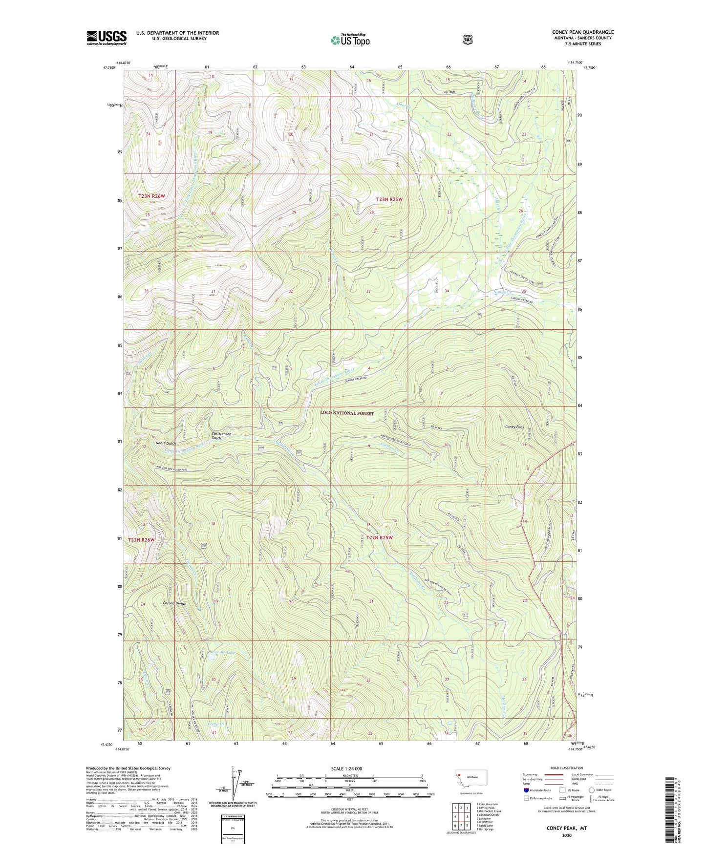
2020 topographic map quadrangle Coney Peak in the state of Montana. Scale: 1:24000. Based on the newly updated USGS 7.5' US Topo map series, this map is in the following counties: Sanders. The map contains contour data, water features, and other items you are used to seeing on USGS maps, but also has updated roads and other features. This is the next generation of topographic maps. Printed on high-quality waterproof paper with UV fade-resistant inks.
Quads adjacent to this one:
West: Loneman Creek
Northwest: Cook Mountain
North: Bassoo Peak
Northeast: Mill Pocket Creek
East: Lonepine
Southeast: Hot Springs
South: Baldy Lake
Southwest: Weeksville
Contains the following named places: Alder Creek, Cabin Creek, Christensen Gulch, Coney Peak, Corona Divide, Corona Lake, Foolhen Creek, McGinnis Creek, McGinnis Ditch, Nancy Creek, Noble Gulch, Snider Creek, Tepee Creek