
MyTopo
Cook Creek Butte Montana US Topo Map
Couldn't load pickup availability
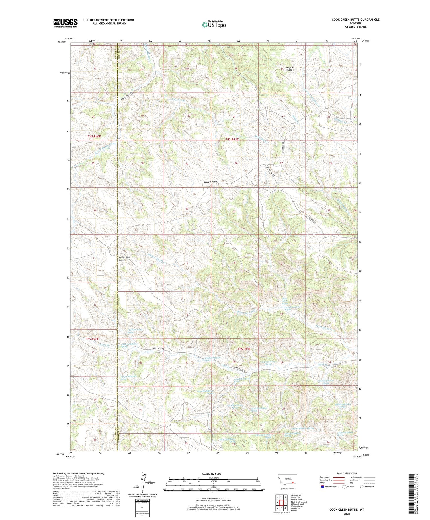
2020 topographic map quadrangle Cook Creek Butte in the state of Montana. Scale: 1:24000. Based on the newly updated USGS 7.5' US Topo map series, this map is in the following counties: Rosebud, Big Horn. The map contains contour data, water features, and other items you are used to seeing on USGS maps, but also has updated roads and other features. This is the next generation of topographic maps. Printed on high-quality waterproof paper with UV fade-resistant inks.
Quads adjacent to this one:
West: Bull Creek Lookout
Northwest: Painted Hill
North: Lame Deer
Northeast: Fisher Butte
East: Clubfoot Creek
Southeast: Birney
South: Birney SW
Southwest: Taintor Desert
Contains the following named places: 05N41E28ABCC01 Spring, 05S41E07CCDA01 Spring, 05S41E10ACBC01 Spring, 05S41E15CBDA01 Spring, 05S41E16CDDD01 Spring, 05S41E17ADCD01 Spring, 05S41E18BBC_01 Well, 05S41E18BBCD01 Spring, 05S41E18CBCD01 Spring, 05S41E20DDDB01 Well, 05S41E21BBCC01 Spring, 05S41E21CAA_01 Well, 05S41E21CAAA01 Spring, 05S41E21DABB01 Spring, 05S41E22DCDC01 Spring, 05S41E23BAAC01 Spring, 05S41E23DBAA01 Spring, 05S41E26ABA_01 Well, 05S41E26ABAC01 Spring, 05S41E27ABBC01 Spring, 05S41E27BABD01 Spring, 05S41E28ABC_01 Well, Buffalo Jump, Cook Creek Butte, Muddy School, Saint Johns Spring, Wild Hog Creek


