MyTopo
Fisher Butte Montana US Topo Map
Couldn't load pickup availability
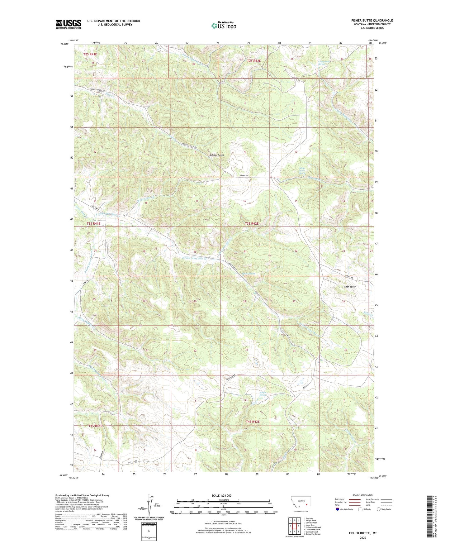
2024 topographic map quadrangle Fisher Butte in the state of Montana. Scale: 1:24000. Based on the newly updated USGS 7.5' US Topo map series, this map is in the following counties: Rosebud. The map contains contour data, water features, and other items you are used to seeing on USGS maps, but also has updated roads and other features. This is the next generation of topographic maps. Printed on high-quality waterproof paper with UV fade-resistant inks.
Quads adjacent to this one:
West: Lame Deer
Northwest: Jimtown
North: Badger Peak
Northeast: Garfield Peak
East: Hollowwood Creek
Southeast: Birney Day School
South: Clubfoot Creek
Southwest: Cook Creek Butte
This map covers the same area as the classic USGS quad with code o45106e5.
Contains the following named places: 03S41E01BDAA01 Well, 03S42E05AAA_01 Well, 03S42E28ACDC01 Well, Broken Jaw Creek, Crazy Head Pond Number 3 Dam, Crazy Head Spring, East Fork Lame Deer Creek, Fisher Butte, Lame Deer Census Designated Place, Lame Deer District, Lame Deer Strip Mine, Lost Leg Dam, Northern Cheyenne Reservation Division, South Fork Lame Deer Creek, Spang Spring, Standing Elk Creek, Station Spring, White Buffalo Creek, White Horse Spring