MyTopo
Cook Creek Reservoir Montana US Topo Map
Couldn't load pickup availability
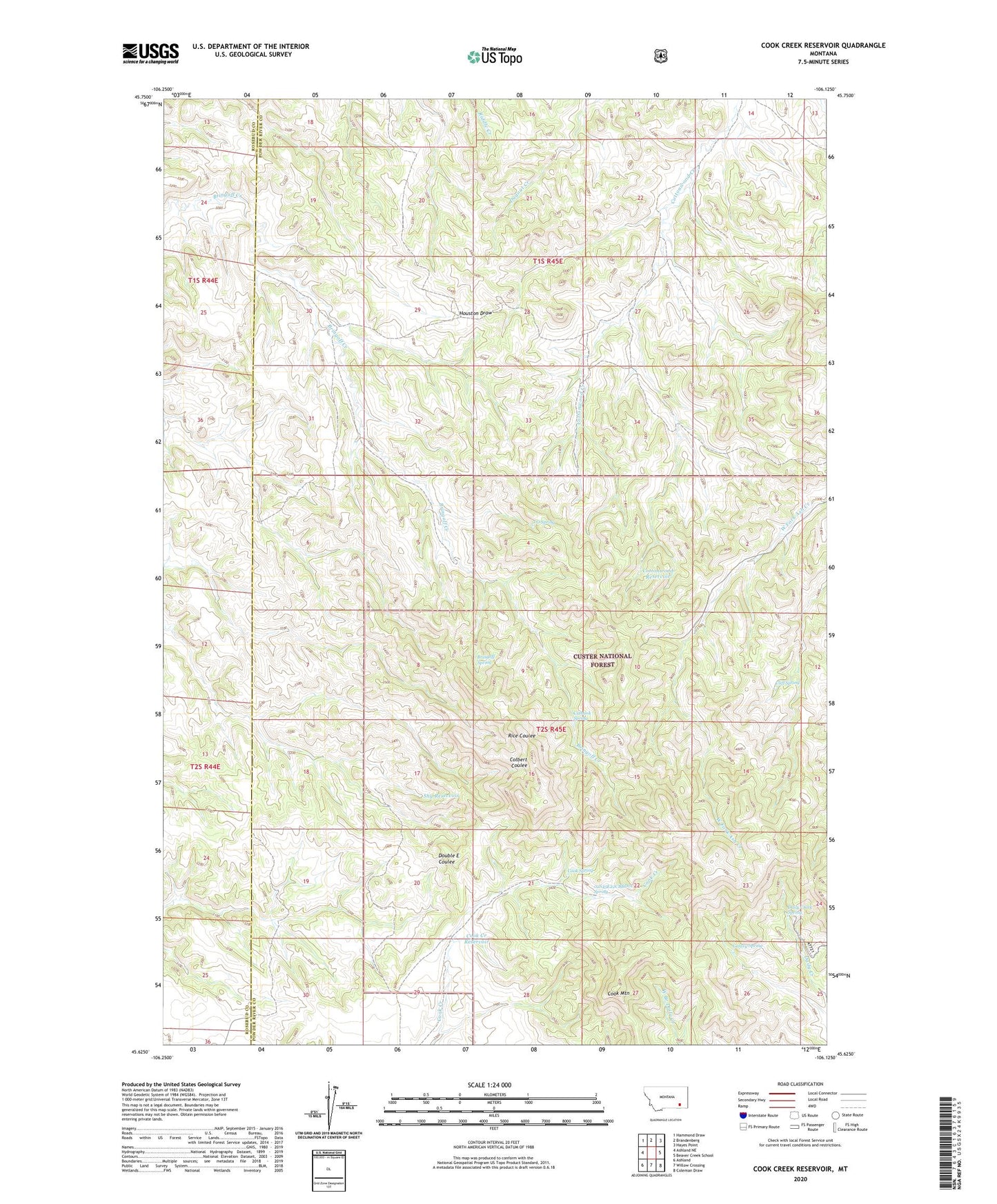
2020 topographic map quadrangle Cook Creek Reservoir in the state of Montana. Scale: 1:24000. Based on the newly updated USGS 7.5' US Topo map series, this map is in the following counties: Powder River, Rosebud. The map contains contour data, water features, and other items you are used to seeing on USGS maps, but also has updated roads and other features. This is the next generation of topographic maps. Printed on high-quality waterproof paper with UV fade-resistant inks.
Quads adjacent to this one:
West: Ashland NE
Northwest: Hammond Draw
North: Brandenberg
Northeast: Hayes Point
East: Beaver Creek School
Southeast: Coleman Draw
South: Willow Crossing
Southwest: Ashland
Contains the following named places: 02S45E04AAAA01 Well, 02S45E17CBBD01 Well, 02S45E22CBBD01 Spring, 02S45E29BAAB01 Well, 04S45E08DDAD01 Well, Bringoff Spring, Cliff Spring, Colbert Coulee Well, Cook Creek Reservoir, Cook Mountain, Cook Spring, Cottonwood Reservoir, Cottonwood Well, Cutbank Spring, Daily Creek Spring, Gentry Spring, J O Spring, Shy Reservoir