MyTopo
Ashland NE Montana US Topo Map
Couldn't load pickup availability
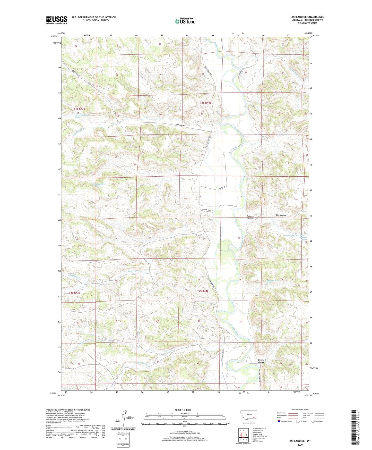
2024 topographic map quadrangle Ashland NE in the state of Montana. Scale: 1:24000. Based on the newly updated USGS 7.5' US Topo map series, this map is in the following counties: Rosebud. The map contains contour data, water features, and other items you are used to seeing on USGS maps, but also has updated roads and other features. This is the next generation of topographic maps. Printed on high-quality waterproof paper with UV fade-resistant inks.
Quads adjacent to this one:
West: Garfield Peak
Northwest: Hammond Draw SW
North: Hammond Draw
Northeast: Brandenberg
East: Cook Creek Reservoir
Southeast: Willow Crossing
South: Ashland
Southwest: Hollowwood Creek
This map covers the same area as the classic USGS quad with code o45106f3.
Contains the following named places: 01S43E25BDDA01 Spring, 01S44E33ABD_01 Well, 02S44E04DDCB01 Well, 02S44E06BCBC01 Spring, 02S44E12BCCA01 Spring, 02S44E14CB__01 Spring, 02S44E18CBBA01 Well, 02S44E27ADCC01 Well, Bowers Ranch, Bringoff Creek, Burning Creek, Colbert Coulee, Double E Coulee, Lake Creek, Lay Creek, McDowell Post Office, Reservation Creek, Rice Coulee, South Brandenburg School, South Fork Lay Creek, Stebbins Creek, Wakefield Spring