MyTopo
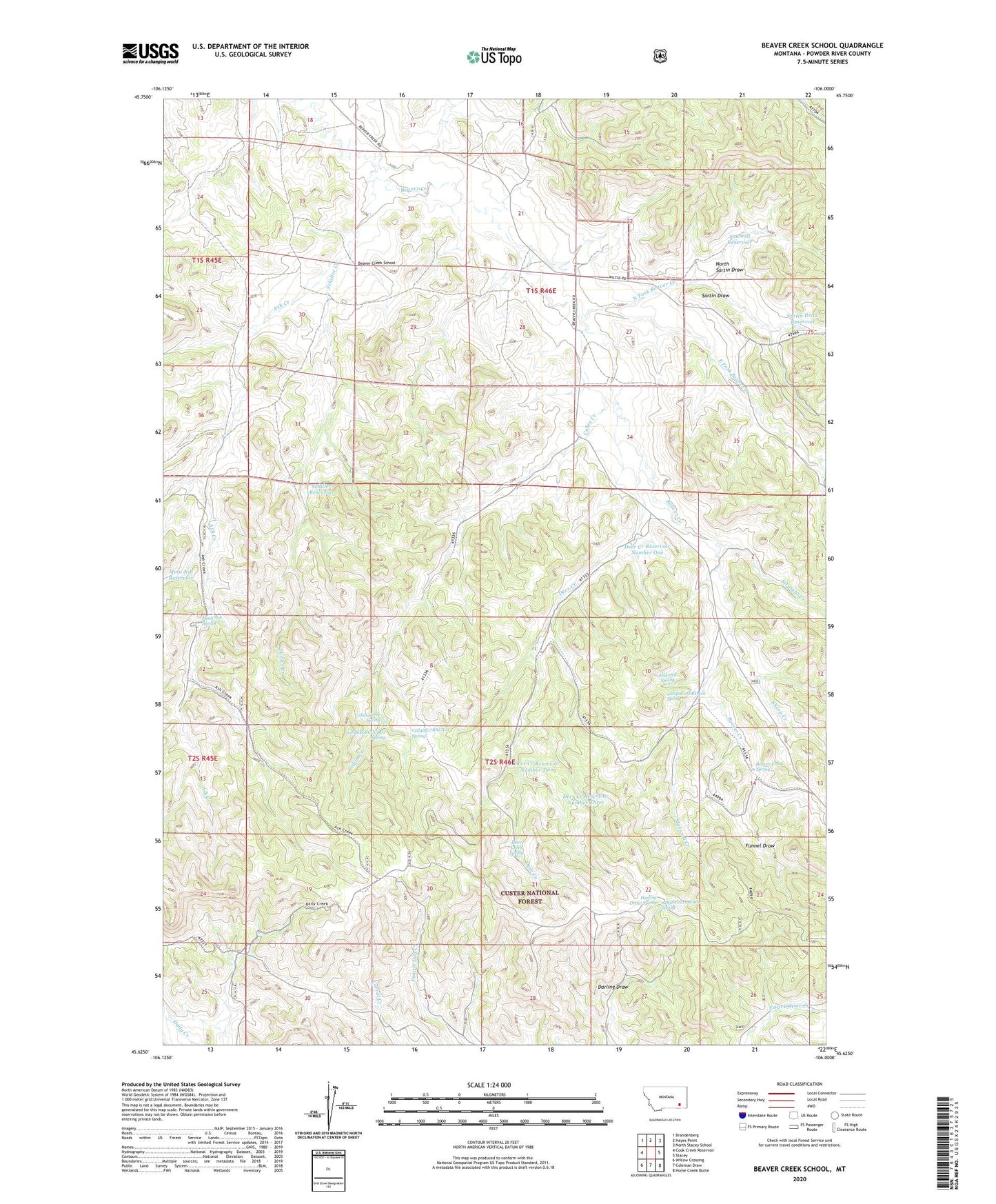
Beaver Creek School Montana US Topo Map
Couldn't load pickup availability
Also explore the Beaver Creek School Forest Service Topo of this same quad for updated USFS data
2024 topographic map quadrangle Beaver Creek School in the state of Montana. Scale: 1:24000. Based on the newly updated USGS 7.5' US Topo map series, this map is in the following counties: Powder River. The map contains contour data, water features, and other items you are used to seeing on USGS maps, but also has updated roads and other features. This is the next generation of topographic maps. Printed on high-quality waterproof paper with UV fade-resistant inks.
Quads adjacent to this one:
West: Cook Creek Reservoir
Northwest: Brandenberg
North: Hayes Point
Northeast: North Stacey School
East: Stacey
Southeast: Home Creek Butte
South: Coleman Draw
Southwest: Willow Crossing
This map covers the same area as the classic USGS quad with code o45106f1.
Contains the following named places: 01S45E25DDCA01 Well, 01S45E36DABC01 Well, 01S46E21DCBC01 Well, 01S46E27BCBC01 Well, 01S46E28ADDD01 Well, 01S46E28BAAB01 Well, 01S46E29BBDA01 Well, 01S46E30ADCA01 Well, 01S46E30ADCA02 Well, 01S46E30DBDC01 Well, 01S46E33DADB01 Well, 01S46E34CBDA01 Well, 02S46E02DBBB01 Well, 02S46E03CA__01 Well, 02S46E05AACB01 Well, 02S46E08CCCD01 Spring, 02S46E09ACBD01 Well, 02S46E10DBDA01 Spring, 02S46E15BDBC01 Well, 02S46E17BACA01 Spring, 02S46E22DBCA01 Spring, Ash Creek, Beaver Creek School, Beaver Creek Spring, Cabin Creek, Cabin Creek Spring, Cabin Creek Well, Darling Draw Spring, Deer Creek, Deer Creek Reservoir Number One, Deer Creek Reservoir Number Three, Deer Creek Reservoir Number Two, Deer Creek Spring, East Fork Beaver Creek, Funnel Draw, Lower Deer Creek Well, Main Ash Reservoir, Main Ash Spring, Maxwell Creek, Maxwell Spring, Maxwell Well, North Fork Beaver Creek, North Sartin Draw, Sartin Draw, Sartin Draw Reservoir, Sawmill Reservoir, Schiller Creek, Schiller Reservoir, Sheep Creek, Straight Creek, Upper Deer Creek Well, West Fork Ash Creek