MyTopo
Corinth Montana US Topo Map
Couldn't load pickup availability
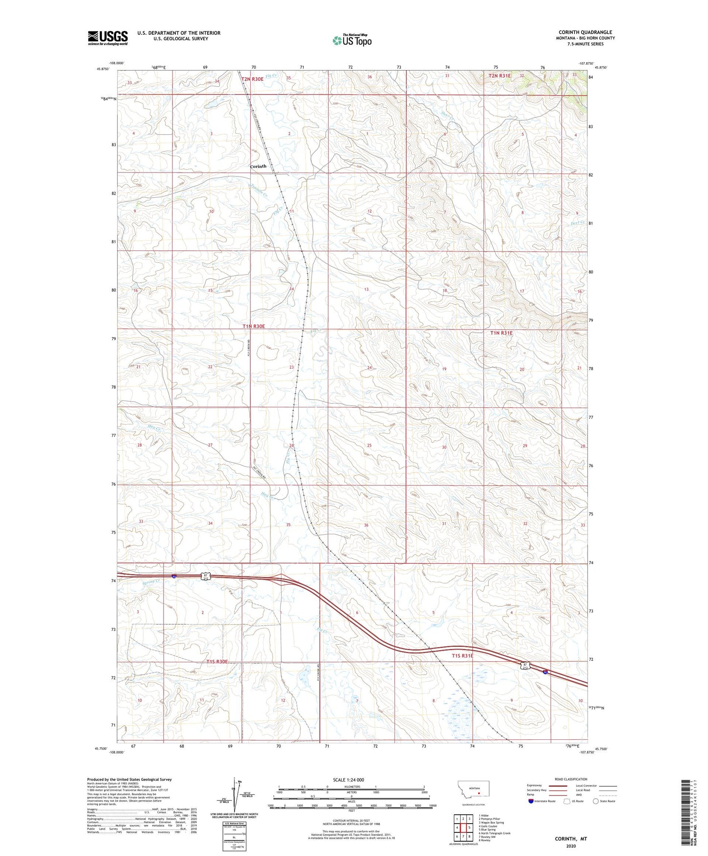
2024 topographic map quadrangle Corinth in the state of Montana. Scale: 1:24000. Based on the newly updated USGS 7.5' US Topo map series, this map is in the following counties: Big Horn. The map contains contour data, water features, and other items you are used to seeing on USGS maps, but also has updated roads and other features. This is the next generation of topographic maps. Printed on high-quality waterproof paper with UV fade-resistant inks.
Quads adjacent to this one:
West: Gails Coulee
Northwest: Nibbe
North: Pompeys Pillar
Northeast: Wagon Box Spring
East: Blue Spring
Southeast: Rowley
South: Rowley NW
Southwest: North Telegraph Creek
This map covers the same area as the classic USGS quad with code o45107g8.
Contains the following named places: Corinth, Corinth Post Office, Corinth School, Hay Creek, Kjeldgaard Number 1 Dam, Spring Creek, Tenmile Creek, ZIP Code: 59064