MyTopo
Crater Lake Montana US Topo Map
Couldn't load pickup availability
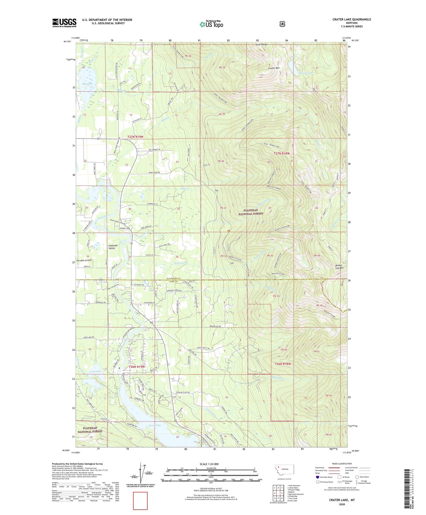
2020 topographic map quadrangle Crater Lake in the state of Montana. Scale: 1:24000. Based on the newly updated USGS 7.5' US Topo map series, this map is in the following counties: Flathead, Lake. The map contains contour data, water features, and other items you are used to seeing on USGS maps, but also has updated roads and other features. This is the next generation of topographic maps. Printed on high-quality waterproof paper with UV fade-resistant inks.
Quads adjacent to this one:
West: Bigfork
Northwest: Hash Mountain
North: Jewel Basin
Northeast: Pioneer Ridge
East: Big Hawk Mountain
Southeast: Swan Lake
South: Yew Creek
Southwest: Woods Bay
Contains the following named places: 26N19W11BBDD01 Well, Bear Creek, Bear Creek Village, Birch Creek, Broken Leg Mountain, Crater Lake, Crater Mountain, Deer Creek, Flathead Valley, Horseshoe Lake, Horseshoe Lake - Ferndale Fishing Access Site, Johnson Creek, Loon Lake, Loon Lake Access, Meadow Creek, Montana State Highway 83 Weigh Staton, Mud Lake, Patterson Creek, Peterson Creek, Peterson Creek Trail, Rocky Creek, Schmidt Creek, Swan River Fishing Access Site, Wolf Creek, Wolf Creek Trail