MyTopo
Woods Bay Montana US Topo Map
Couldn't load pickup availability
Also explore the Woods Bay Forest Service Topo of this same quad for updated USFS data
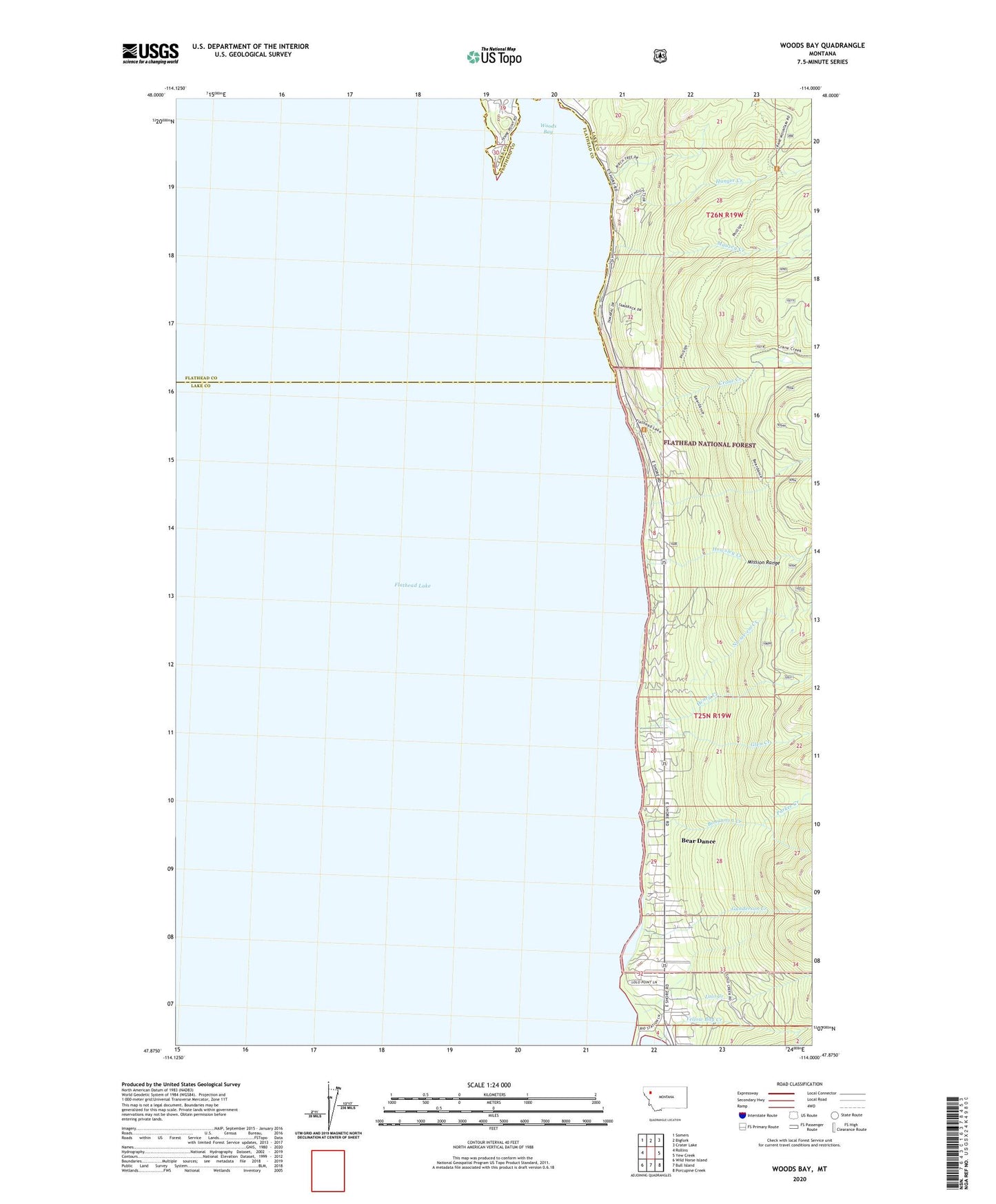
2024 topographic map quadrangle Woods Bay in the state of Montana. Scale: 1:24000. Based on the newly updated USGS 7.5' US Topo map series, this map is in the following counties: Lake, Flathead. The map contains contour data, water features, and other items you are used to seeing on USGS maps, but also has updated roads and other features. This is the next generation of topographic maps. Printed on high-quality waterproof paper with UV fade-resistant inks.
Quads adjacent to this one:
West: Rollins
Northwest: Somers
North: Bigfork
Northeast: Crater Lake
East: Yew Creek
Southeast: Porcupine Creek
South: Bull Island
Southwest: Wild Horse Island
This map covers the same area as the classic USGS quad with code o47114h1.
Contains the following named places: 25N19W32DAA_01 Well, Bear Dance, Bear Dance Census Designated Place, Beardance Picnic Area, Bohannon Creek, Crane Creek, Flathead Community Center, Flathead Lake State Park - Yellow Bay Unit, Flathead Picnic Area, Glen Creek, Glen Post Office, Glen School, Gunderson Creek, Henry Creek, Howsley Creek, Hunger Creek, Lolo Creek, Mauzey Creek, No-see-em Creek, Parker Creek, University of Montana Biological Station, Woods Bay, Yellow Bay, Yellow Bay Campground, Yellow Bay Creek