
MyTopo
Cushman Montana US Topo Map
Couldn't load pickup availability
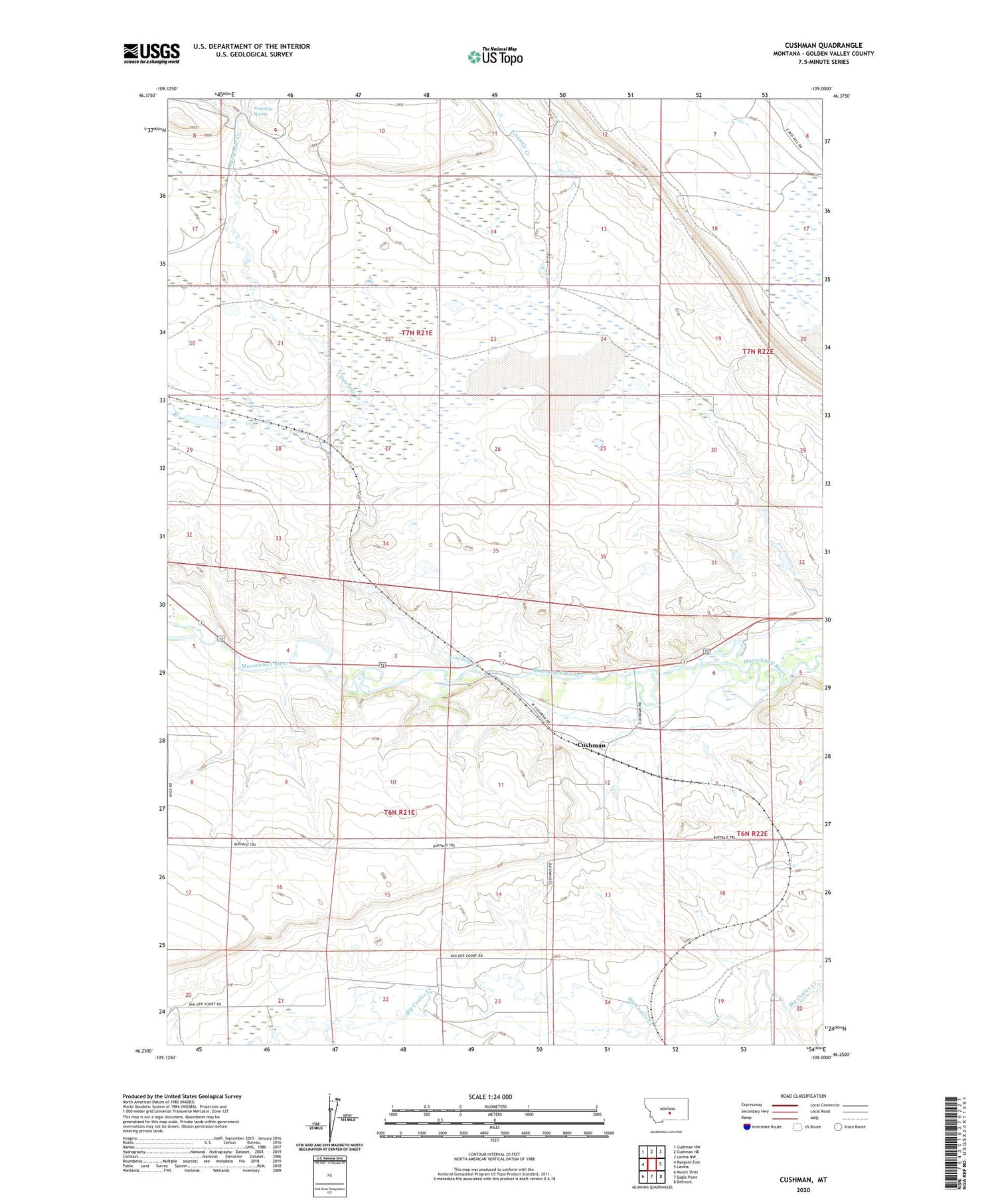
2020 topographic map quadrangle Cushman in the state of Montana. Scale: 1:24000. Based on the newly updated USGS 7.5' US Topo map series, this map is in the following counties: Golden Valley. The map contains contour data, water features, and other items you are used to seeing on USGS maps, but also has updated roads and other features. This is the next generation of topographic maps. Printed on high-quality waterproof paper with UV fade-resistant inks.
Quads adjacent to this one:
West: Ryegate East
Northwest: Cushman NW
North: Cushman NE
Northeast: Lavina NW
East: Lavina
Southeast: Belmont
South: Eagle Point
Southwest: Mount Sinai
Contains the following named places: 06N21E22BDA_01 Well, 06N21E24CAA_01 Well, 06N22E19CDAB01 Well, Burgoyne Post Office, Burgoyne Siding, Cushman, Cushman Post Office, Fratt, Gerdts Dam, Ninemile Creek, Ninemile Spring, Olden Post Office, Slayton, Slayton Junction, Slayton Post Office, Vebar


