MyTopo
Cushman NW Montana US Topo Map
Couldn't load pickup availability
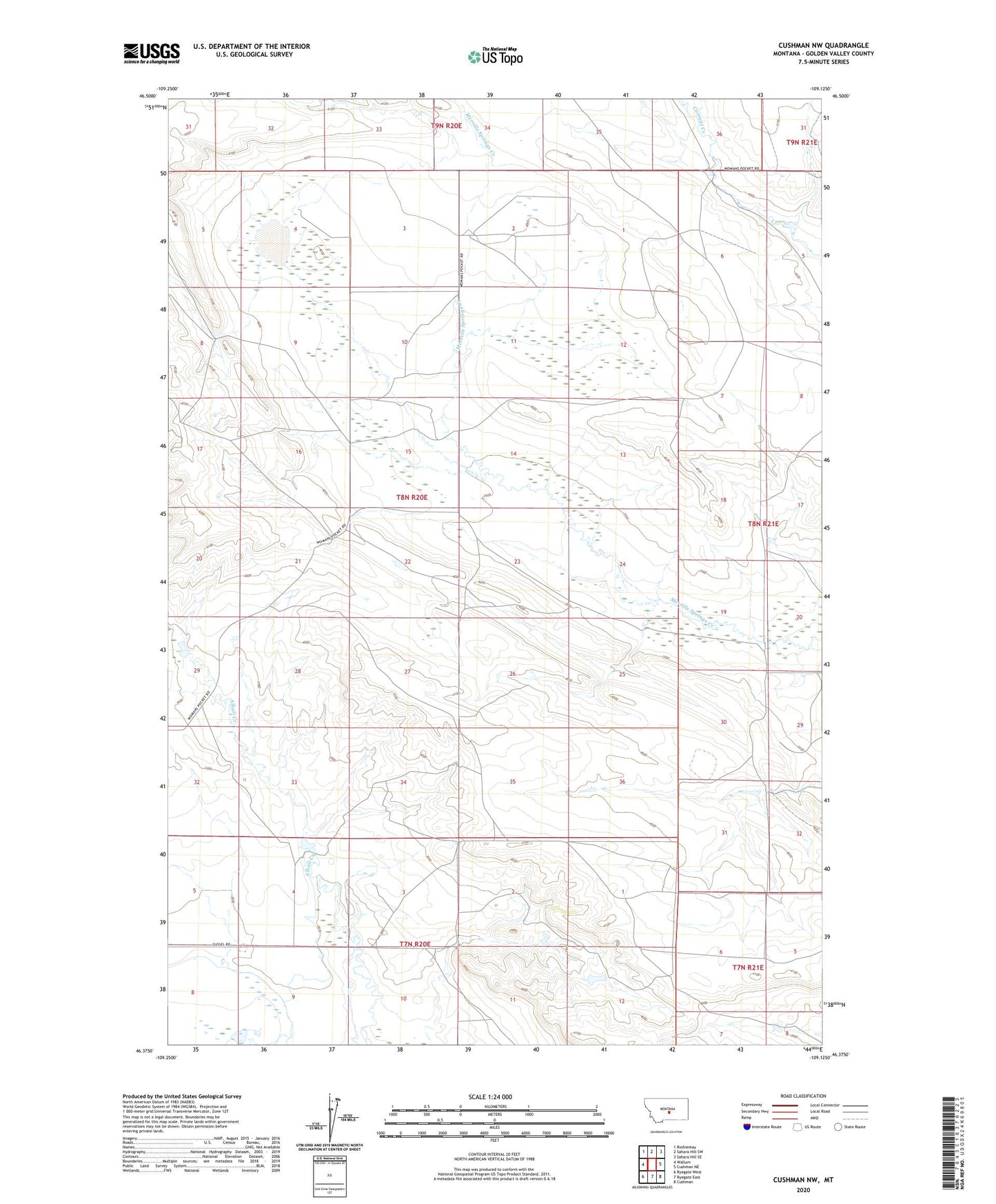
2024 topographic map quadrangle Cushman NW in the state of Montana. Scale: 1:24000. Based on the newly updated USGS 7.5' US Topo map series, this map is in the following counties: Golden Valley. The map contains contour data, water features, and other items you are used to seeing on USGS maps, but also has updated roads and other features. This is the next generation of topographic maps. Printed on high-quality waterproof paper with UV fade-resistant inks.
Quads adjacent to this one:
West: Wallum
Northwest: Rothiemay
North: Sahara Hill SW
Northeast: Sahara Hill SE
East: Cushman NE
Southeast: Cushman
South: Ryegate East
Southwest: Ryegate West
This map covers the same area as the classic USGS quad with code o46109d2.
Contains the following named places: 07N21E05BBC_01 Well, 08N21E30BBD_01 Well, Babbit Dam, George Rath Number 3 Dam, Golden Valley County, Hammer Number 1 Dam