MyTopo
Cut Bank SE Montana US Topo Map
Couldn't load pickup availability
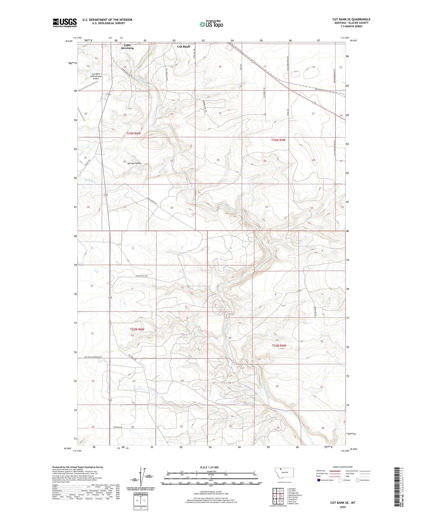
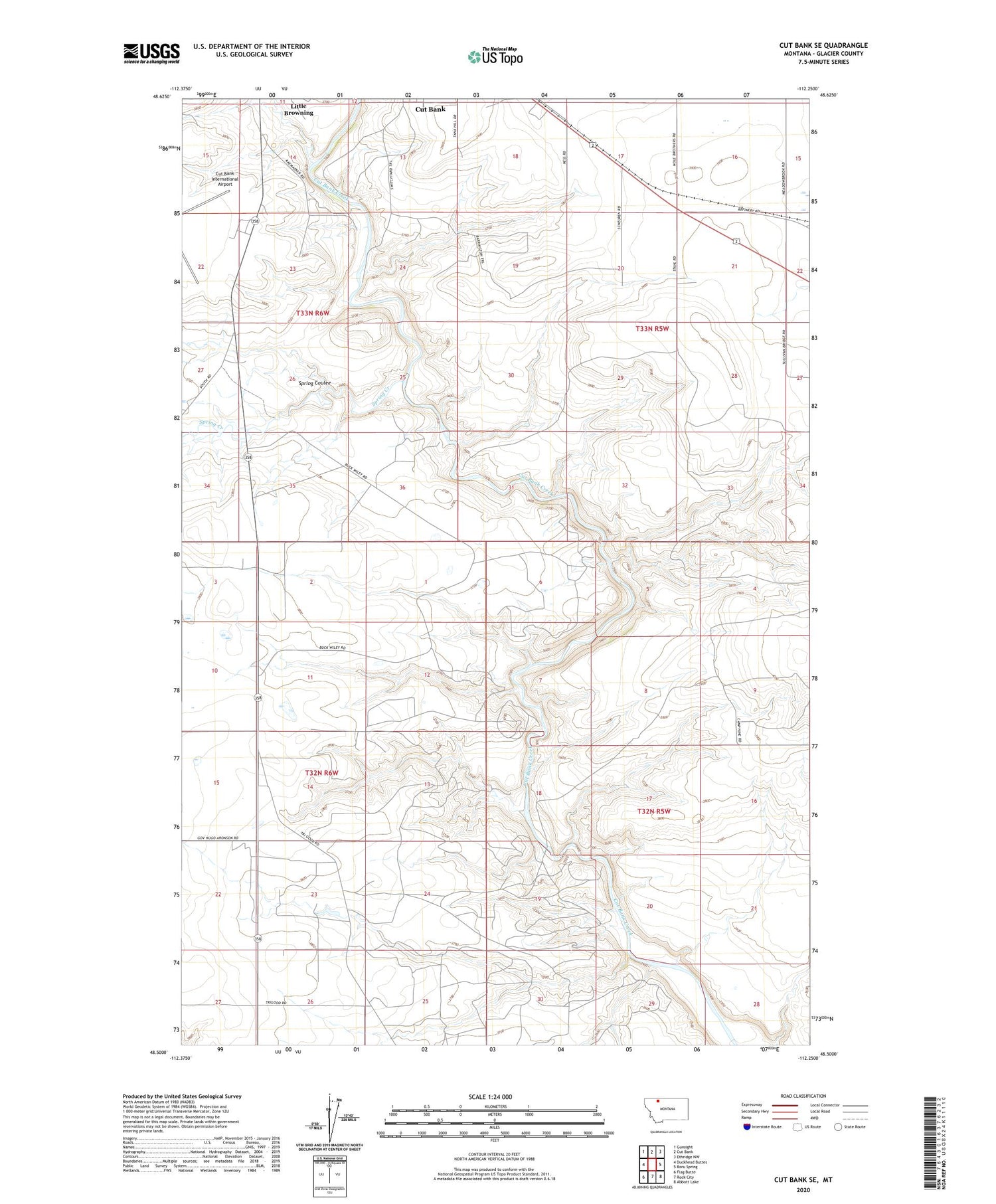
2020 topographic map quadrangle Cut Bank SE in the state of Montana. Scale: 1:24000. Based on the newly updated USGS 7.5' US Topo map series, this map is in the following counties: Glacier. The map contains contour data, water features, and other items you are used to seeing on USGS maps, but also has updated roads and other features. This is the next generation of topographic maps. Printed on high-quality waterproof paper with UV fade-resistant inks.
Quads adjacent to this one:
West: Duckhead Buttes
Northwest: Gunsight
North: Cut Bank
Northeast: Ethridge NW
East: Boru Spring
Southeast: Abbott Lake
South: Rock City
Southwest: Flag Butte
Contains the following named places: 32N05W16AACC01 Well, 32N05W16BC__01 Well, 32N05W30BB__01 Well, 32N05W30BD__02 Well, 32N05W30BDDA01 Well, 32N05W30DC__01 Well, 32N06W01AC__01 Well, 32N06W24DA__01 Well, 32N06W25AD__01 Well, 33N05W17AD__01 Well, 33N05W17DA__01 Well, 33N05W17DA__02 Well, 33N05W19AB__01 Well, 33N05W20DA__01 Well, 33N05W21BB__01 Well, 33N05W21BBBD02 Well, 33N05W21BC__01 Well, 33N05W21DA__01 Well, 33N05W22BC__01 Well, 33N05W29CA__01 Well, 33N05W30AA__01 Well, 33N05W32AD__01 Well, 33N06W14CA__01 Well, 33N06W24BB__01 Well, Baltic, Cut Bank Golf and Country Club, Cut Bank International Airport, Spring Coulee, Spring Creek