MyTopo
Ethridge NW Montana US Topo Map
Couldn't load pickup availability
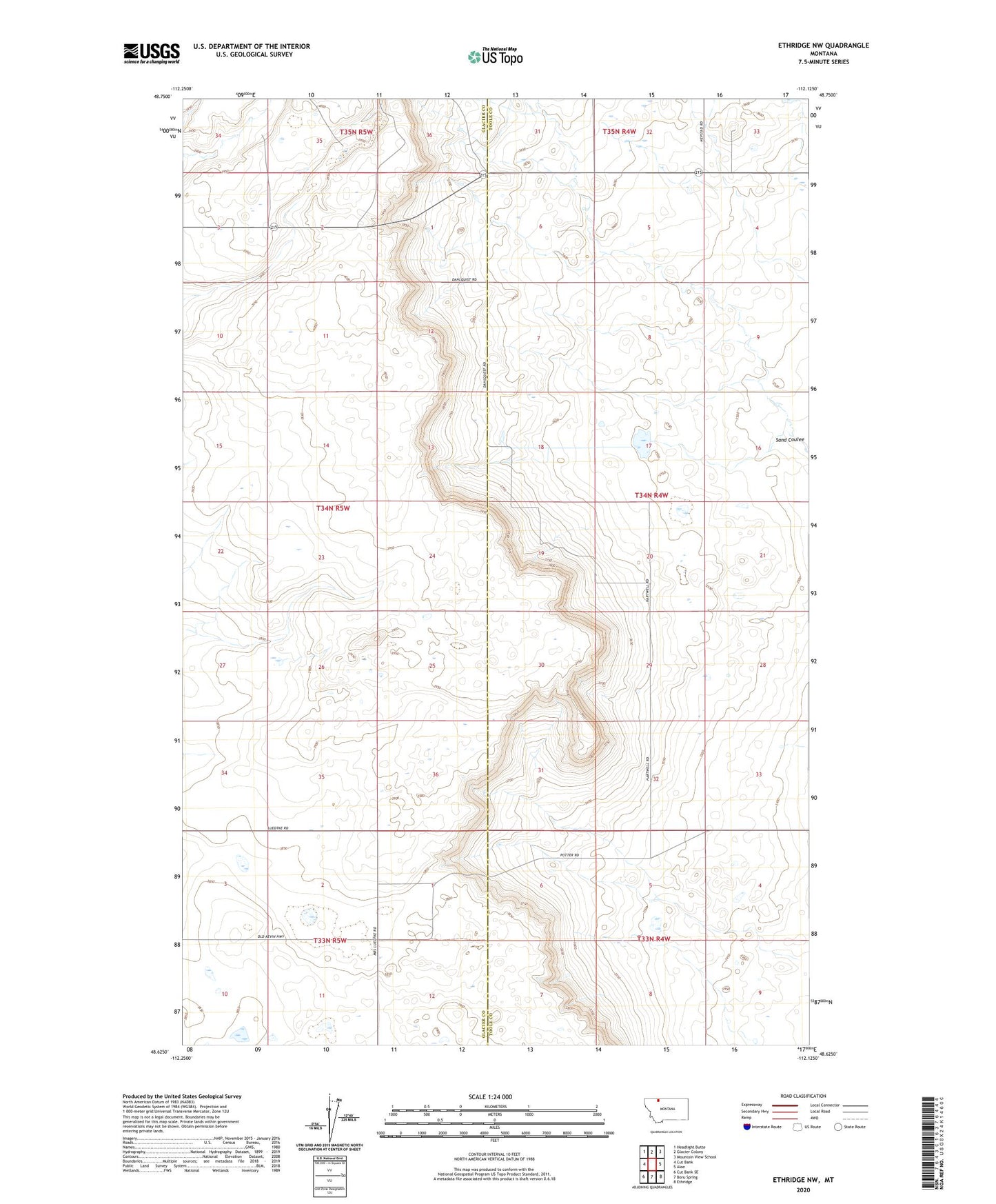
2024 topographic map quadrangle Ethridge NW in the state of Montana. Scale: 1:24000. Based on the newly updated USGS 7.5' US Topo map series, this map is in the following counties: Toole, Glacier. The map contains contour data, water features, and other items you are used to seeing on USGS maps, but also has updated roads and other features. This is the next generation of topographic maps. Printed on high-quality waterproof paper with UV fade-resistant inks.
Quads adjacent to this one:
West: Cut Bank
Northwest: Headlight Butte
North: Glacier Colony
Northeast: Mountain View School
East: Aloe
Southeast: Ethridge
South: Boru Spring
Southwest: Cut Bank SE
This map covers the same area as the classic USGS quad with code o48112f2.
Contains the following named places: 33N05W03BA__01 Well, 33N05W03DC__01 Well, 33N05W11A___01 Well, 33N05W12CC__01 Well, 34N04W31BA__01 Well, 34N05W10AA__01 Well, 34N05W35DC__01 Well, 35N05W34DA__01 Well, 35N05W34DC__01 Well, Horizon Colony, Horizon Colony Census Designated Place, KCTB-FM (Cut Bank)