MyTopo
Gunsight Montana US Topo Map
Couldn't load pickup availability
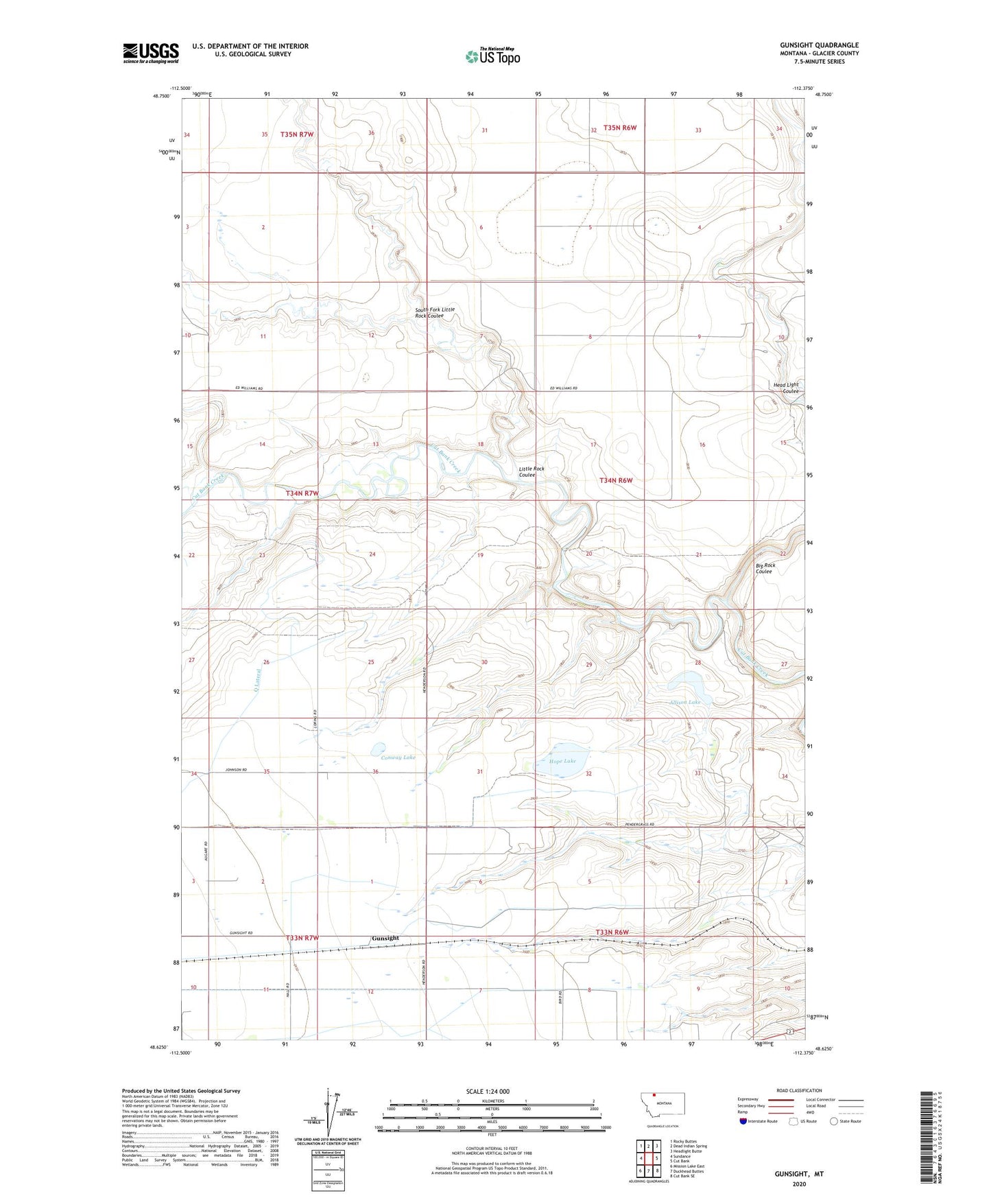
2024 topographic map quadrangle Gunsight in the state of Montana. Scale: 1:24000. Based on the newly updated USGS 7.5' US Topo map series, this map is in the following counties: Glacier. The map contains contour data, water features, and other items you are used to seeing on USGS maps, but also has updated roads and other features. This is the next generation of topographic maps. Printed on high-quality waterproof paper with UV fade-resistant inks.
Quads adjacent to this one:
West: Sundance
Northwest: Rocky Buttes
North: Dead Indian Spring
Northeast: Headlight Butte
East: Cut Bank
Southeast: Cut Bank SE
South: Duckhead Buttes
Southwest: Mission Lake East
This map covers the same area as the classic USGS quad with code o48112f4.
Contains the following named places: 33N06W03CA__01 Well, 33N06W06AB__01 Well, 33N06W10BB__01 Well, 35N06W32AC__01 Well, 35N06W34BC__01 Well, Allison Lake, Big Rock Coulee, Cadmus Post Office, Conway Lake, Gunsight, Head Light Coulee, Hope Lake, Little Rock Coulee, Seville Community Hall, South Fork Little Rock Coulee