MyTopo
Deep Creek SE Montana US Topo Map
Couldn't load pickup availability
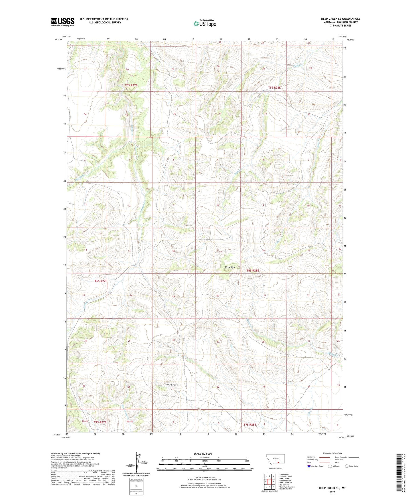
2024 topographic map quadrangle Deep Creek SE in the state of Montana. Scale: 1:24000. Based on the newly updated USGS 7.5' US Topo map series, this map is in the following counties: Big Horn. The map contains contour data, water features, and other items you are used to seeing on USGS maps, but also has updated roads and other features. This is the next generation of topographic maps. Printed on high-quality waterproof paper with UV fade-resistant inks.
Quads adjacent to this one:
West: Deep Creek SW
Northwest: Deep Creek
North: Chilkoot Coulee
Northeast: Bear Coulee
East: Bear Coulee SW
Southeast: Dead Indian Hill
South: East Pryor Mountain
Southwest: Big Ice Cave
This map covers the same area as the classic USGS quad with code o45108c3.
Contains the following named places: Little Mountain, Shively Creek