MyTopo
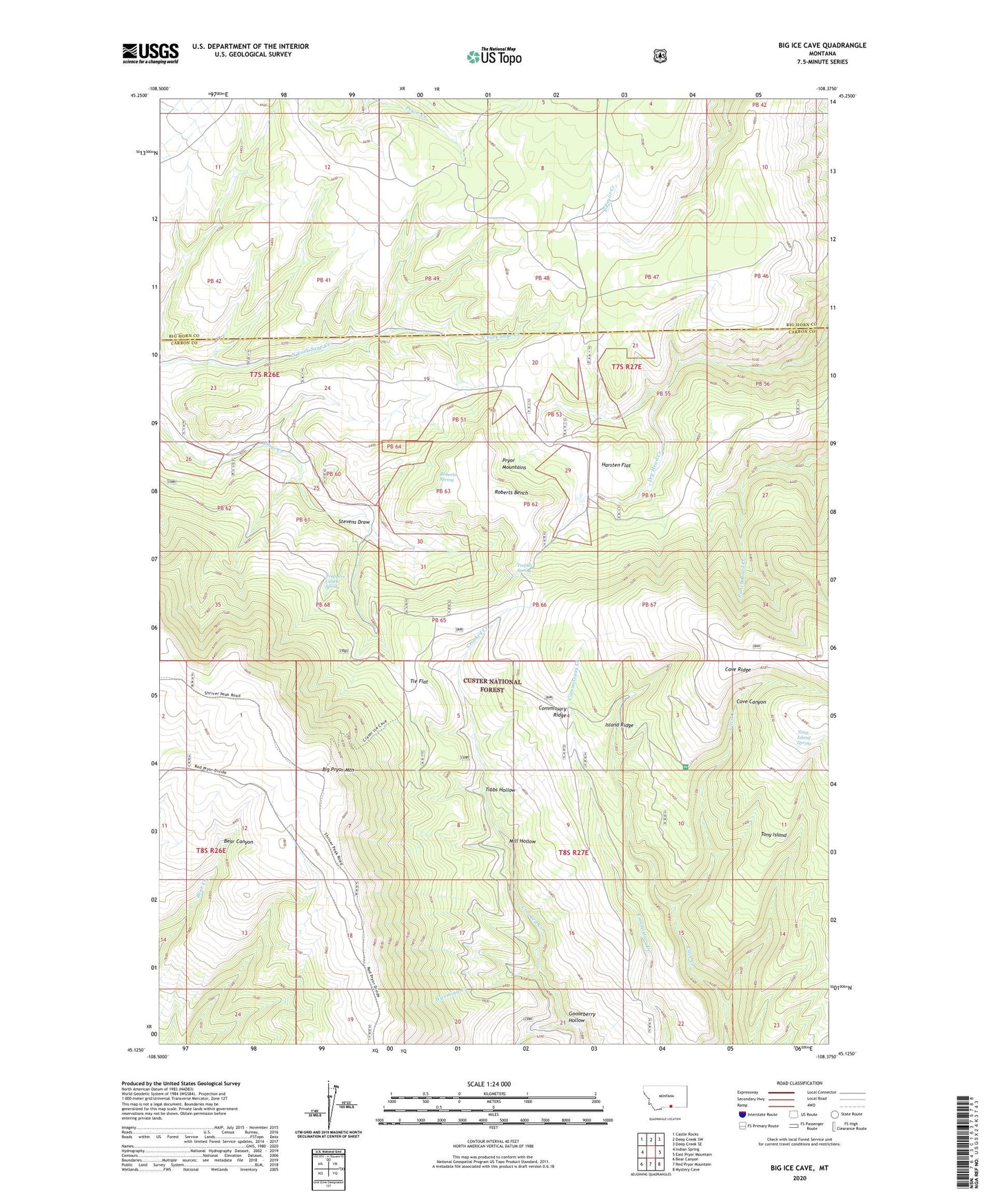
Big Ice Cave Montana US Topo Map
Couldn't load pickup availability
Also explore the Big Ice Cave Forest Service Topo of this same quad for updated USFS data
2024 topographic map quadrangle Big Ice Cave in the state of Montana. Scale: 1:24000. Based on the newly updated USGS 7.5' US Topo map series, this map is in the following counties: Carbon, Big Horn. The map contains contour data, water features, and other items you are used to seeing on USGS maps, but also has updated roads and other features. This is the next generation of topographic maps. Printed on high-quality waterproof paper with UV fade-resistant inks.
Quads adjacent to this one:
West: Indian Spring
Northwest: Castle Rocks
North: Deep Creek SW
Northeast: Deep Creek SE
East: East Pryor Mountain
Southeast: Mystery Cave
South: Red Pryor Mountain
Southwest: Bear Canyon
This map covers the same area as the classic USGS quad with code o45108b4.
Contains the following named places: Big Ice Cave Campground, Big Pryor Mountain, Cave Ridge, Commissary Ridge, Crooked Creek Guard Station, Gooseberry Hollow, Greenough Ranch, Harsten Flat, Island Ridge, Mill Hollow, Pryor Mountains, Roberts Bench, Roberts Spring, Schwend Ranch, Stevens Draw, Teeples Spring, Tibbs Hollow, Tie Flat, Tony Island, Tony Island Spring, Trappers Cabin Spring, Wyoming Creek