MyTopo
Deep Creek Montana US Topo Map
Couldn't load pickup availability
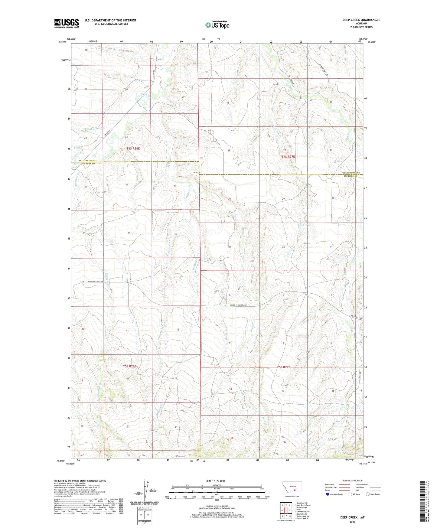
2020 topographic map quadrangle Deep Creek in the state of Montana. Scale: 1:24000. Based on the newly updated USGS 7.5' US Topo map series, this map is in the following counties: Big Horn, Yellowstone. The map contains contour data, water features, and other items you are used to seeing on USGS maps, but also has updated roads and other features. This is the next generation of topographic maps. Printed on high-quality waterproof paper with UV fade-resistant inks.
Quads adjacent to this one:
West: Pryor
Northwest: Stratford Hill
North: Vale Creek Ranch
Northeast: Soda Springs
East: Chilkoot Coulee
Southeast: Deep Creek SE
South: Deep Creek SW
Southwest: Castle Rocks
Contains the following named places: 04S26E13BCBC01 Well, 05S27E15BCBB01 Well, Cottonwood Creek, Deep Creek, Fourth of July Creek, Gc Lande Number 1 Dam, Middle Creek, Middle Creek School, Plum Creek, Porcupine Creek, Smallpox Creek