MyTopo
Vale Creek Ranch Montana US Topo Map
Couldn't load pickup availability
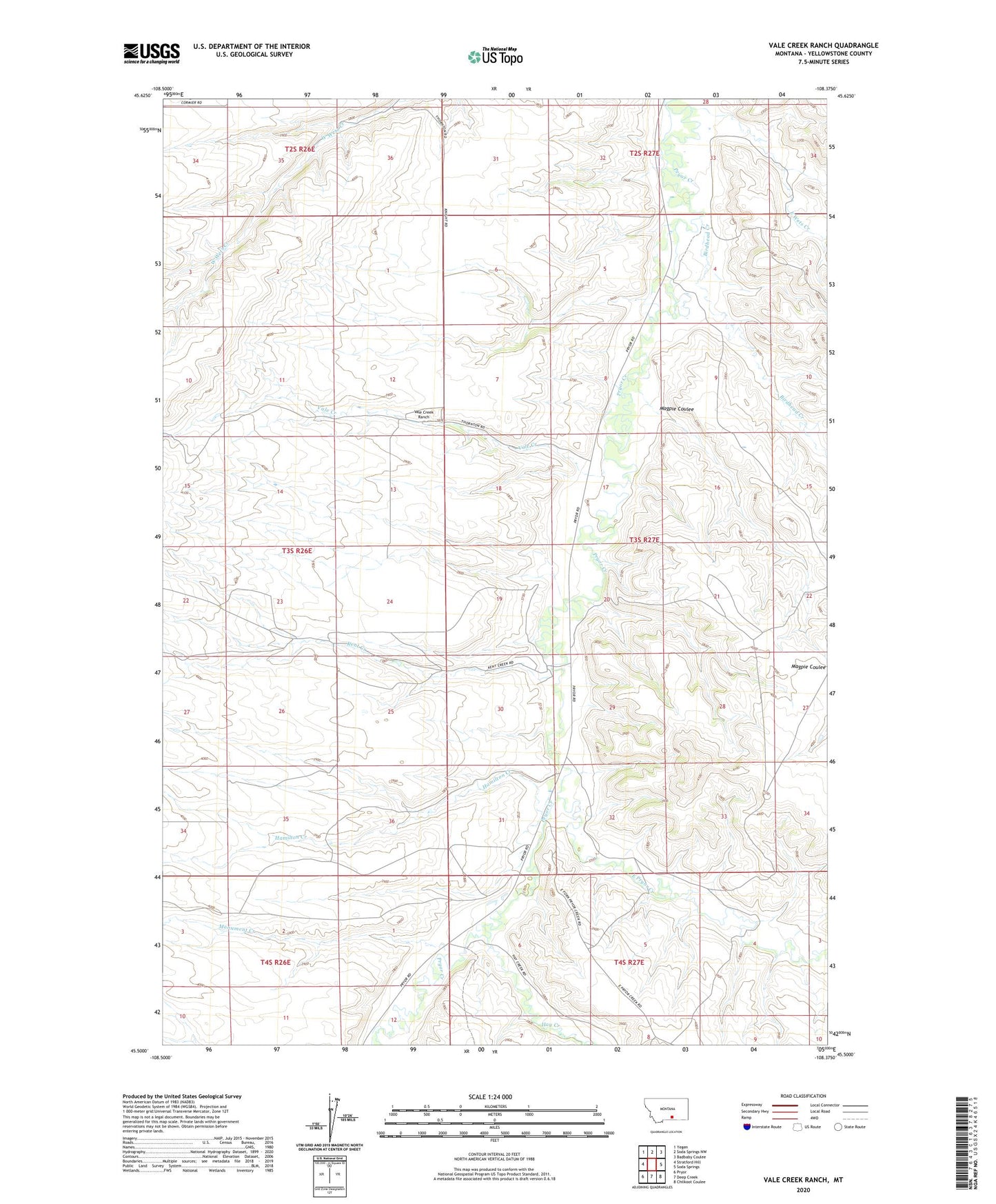
2024 topographic map quadrangle Vale Creek Ranch in the state of Montana. Scale: 1:24000. Based on the newly updated USGS 7.5' US Topo map series, this map is in the following counties: Yellowstone. The map contains contour data, water features, and other items you are used to seeing on USGS maps, but also has updated roads and other features. This is the next generation of topographic maps. Printed on high-quality waterproof paper with UV fade-resistant inks.
Quads adjacent to this one:
West: Stratford Hill
Northwest: Yegen
North: Soda Springs NW
Northeast: Badbaby Coulee
East: Soda Springs
Southeast: Chilkoot Coulee
South: Deep Creek
Southwest: Pryor
This map covers the same area as the classic USGS quad with code o45108e4.
Contains the following named places: 03S26E12DDBC01 Well, 03S27E04BCDD01 Well, 04S27E04BDBD01 Well, 04S27E06BCCB01 Well, 59101, Birdhead Creek, East Pryor Creek, East Wets Creek, Hamilton Creek, Hay Creek, Kent Creek, Magpie Coulee, Monument Creek, Vale Creek, Vale Creek Ranch