MyTopo
Pryor Montana US Topo Map
Couldn't load pickup availability
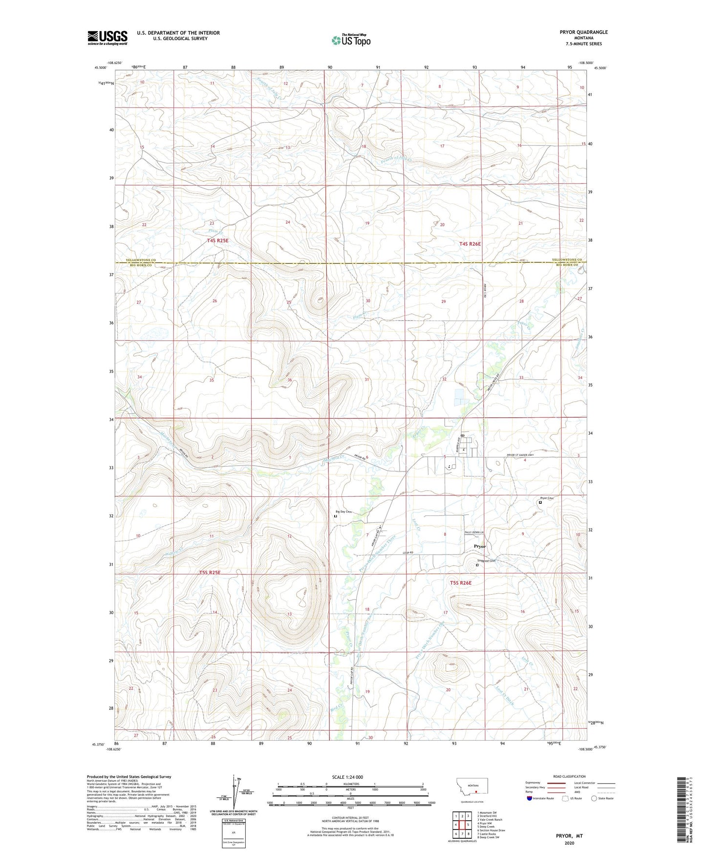
2024 topographic map quadrangle Pryor in the state of Montana. Scale: 1:24000. Based on the newly updated USGS 7.5' US Topo map series, this map is in the following counties: Big Horn, Yellowstone. The map contains contour data, water features, and other items you are used to seeing on USGS maps, but also has updated roads and other features. This is the next generation of topographic maps. Printed on high-quality waterproof paper with UV fade-resistant inks.
Quads adjacent to this one:
West: Pryor NW
Northwest: Mossmain SW
North: Stratford Hill
Northeast: Vale Creek Ranch
East: Deep Creek
Southeast: Deep Creek SW
South: Castle Rocks
Southwest: Section House Draw
This map covers the same area as the classic USGS quad with code o45108d5.
Contains the following named places: 04S26E30DDBB01 Well, 05S25E14DCDC01 Well, Big Day Cemetery, Bird Creek, Chief Plenty Coups Museum, Chief Plenty Coups State Park, Faith Baptist Church, Lost Creek, Lost Creek Ditch, Macheta Creek, Plenty Coups High School, Pryor, Pryor Cemetery, Pryor Census Designated Place, Pryor Creek Boarding School, Pryor Ditch Number One, Pryor Ditch Number Three, Pryor Ditch Number Two, Pryor Elementary School, Pryor Post Office, Pryor Valley Assembly Church, Saint Charles Borromeo Church, Saint Charles Mission School, Singgood Cemetery, Upper Pryor School, Willow Creek