MyTopo
Devils Fence Montana US Topo Map
Couldn't load pickup availability
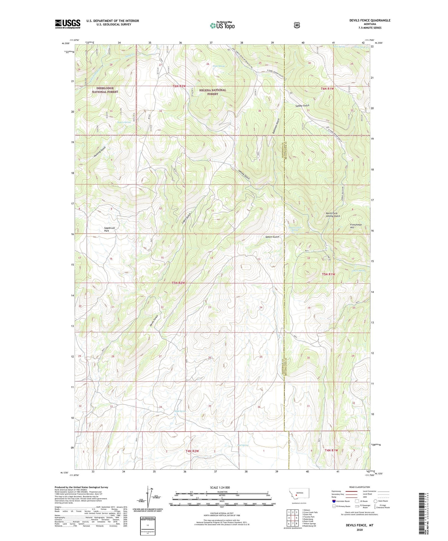
2020 topographic map quadrangle Devils Fence in the state of Montana. Scale: 1:24000. Based on the newly updated USGS 7.5' US Topo map series, this map is in the following counties: Jefferson, Broadwater. The map contains contour data, water features, and other items you are used to seeing on USGS maps, but also has updated roads and other features. This is the next generation of topographic maps. Printed on high-quality waterproof paper with UV fade-resistant inks.
Quads adjacent to this one:
West: Tacoma Park
Northwest: Elkhorn
North: Crow Creek Falls
Northeast: Giant Hill
East: Radersburg
Southeast: Radersburg SW
South: Willow Springs
Southwest: Dunn Creek
Contains the following named places: Boyd Spring, Dahlman Gulch, Devils Fence, Doughty Ranch, Frenchman Hill, Hope Spring, Kimpton Cow Camp, Lower Spring, North Fork Johnny Gulch, Rogers Spring, Saddle Gulch, Sagebrush Park, Sand Creek, SE NE Section 18 Mine, SE NE Section 31 Mine, SE SE Section 31 Mine, Silver Spring, Spar Mine, Spears Gulch, Spears Gulch Spring, Star Ranch, Trail Spring, Turman Creek