MyTopo
Dunn Creek Montana US Topo Map
Couldn't load pickup availability
Also explore the Dunn Creek Forest Service Topo of this same quad for updated USFS data
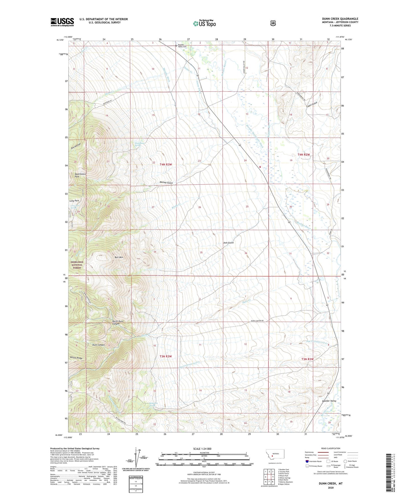
2024 topographic map quadrangle Dunn Creek in the state of Montana. Scale: 1:24000. Based on the newly updated USGS 7.5' US Topo map series, this map is in the following counties: Jefferson. The map contains contour data, water features, and other items you are used to seeing on USGS maps, but also has updated roads and other features. This is the next generation of topographic maps. Printed on high-quality waterproof paper with UV fade-resistant inks.
Quads adjacent to this one:
West: Wilson Park
Northwest: Boulder East
North: Tacoma Park
Northeast: Devils Fence
East: Willow Springs
Southeast: Negro Hollow
South: Doherty Mountain
Southwest: Black Butte
This map covers the same area as the classic USGS quad with code o46111a8.
Contains the following named places: 03N02W06ABA_01 Well, 04N02W30CABA01 Well, 04N02W30CBCB01 Well, 04N02W30DADD01 Well, 04N03W14BC__01 Well, 04N03W25ABAB01 Well, Boulder Valley, Boulder Valley Cemetery, Boulder Valley Church, Brady Creek, Bull Mountain Rural Fire District Station 2, Cabin Gulch, Carey Ditch, Clagett Post Office, Dry Creek, Dry Hollow, Dunn Canyon, Dunn Creek, Jack Gulch, Long Park Spring, McKanna Spring, Mulvey Gulch, Murphy Ditch, Murphy Quaintance Ditch, North Dunn Canyon, Quaintance Ranch, Quaintance Spring, Quinn Creek, Weber Post Office, Weber School