MyTopo
Dutton Montana US Topo Map
Couldn't load pickup availability
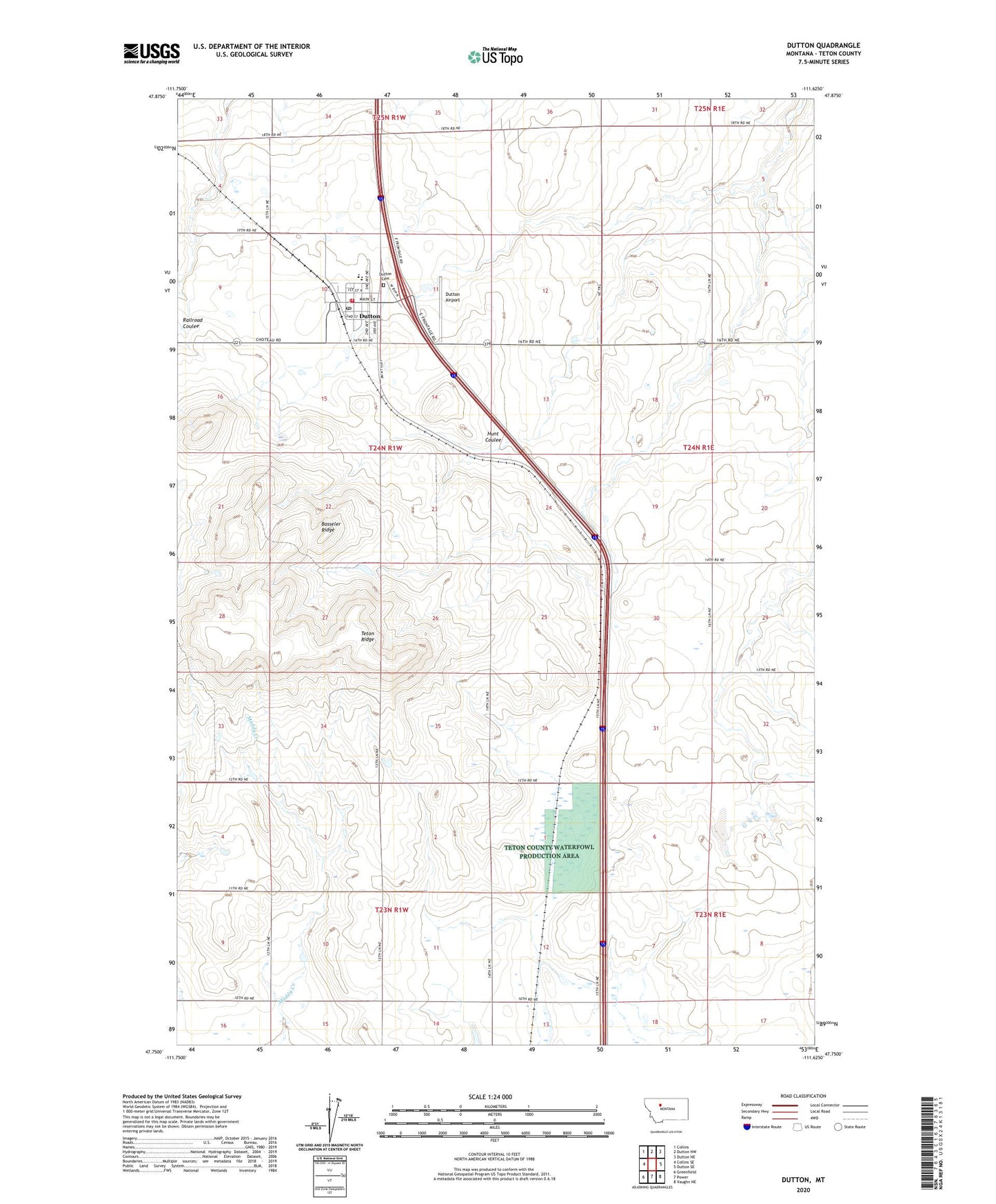
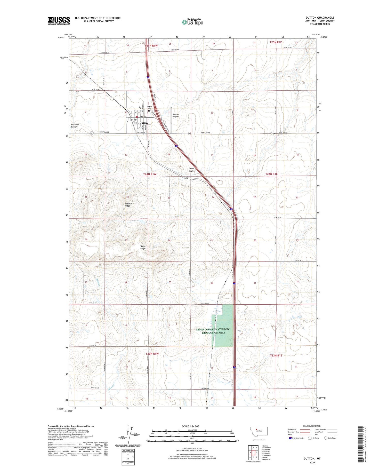
2020 topographic map quadrangle Dutton in the state of Montana. Scale: 1:24000. Based on the newly updated USGS 7.5' US Topo map series, this map is in the following counties: Teton. The map contains contour data, water features, and other items you are used to seeing on USGS maps, but also has updated roads and other features. This is the next generation of topographic maps. Printed on high-quality waterproof paper with UV fade-resistant inks.
Quads adjacent to this one:
West: Collins SE
Northwest: Collins
North: Dutton NW
Northeast: Dutton NE
East: Dutton SE
Southeast: Vaughn NE
South: Power
Southwest: Greenfield
Contains the following named places: 23N01W03AAC_01 Well, Bethany Lutheran Church, Bosseler Ridge, Cargill, Dutton, Dutton Airport, Dutton Cemetery, Dutton Co-operative Elevator, Dutton Farmers Elevator, Dutton Post Office, Dutton Public Library, Dutton Public Schools, Dutton United Methodist Church, Dutton Volunteer Fire Department, Dutton-Power Division, Peavey Elevator, Robbie Dam, Saint Williams Catholic Church, Snider School, Teton Ridge, Thav Dam, Town of Dutton, Triangle Terminal Co-operative Elevator