MyTopo
Vaughn NE Montana US Topo Map
Couldn't load pickup availability
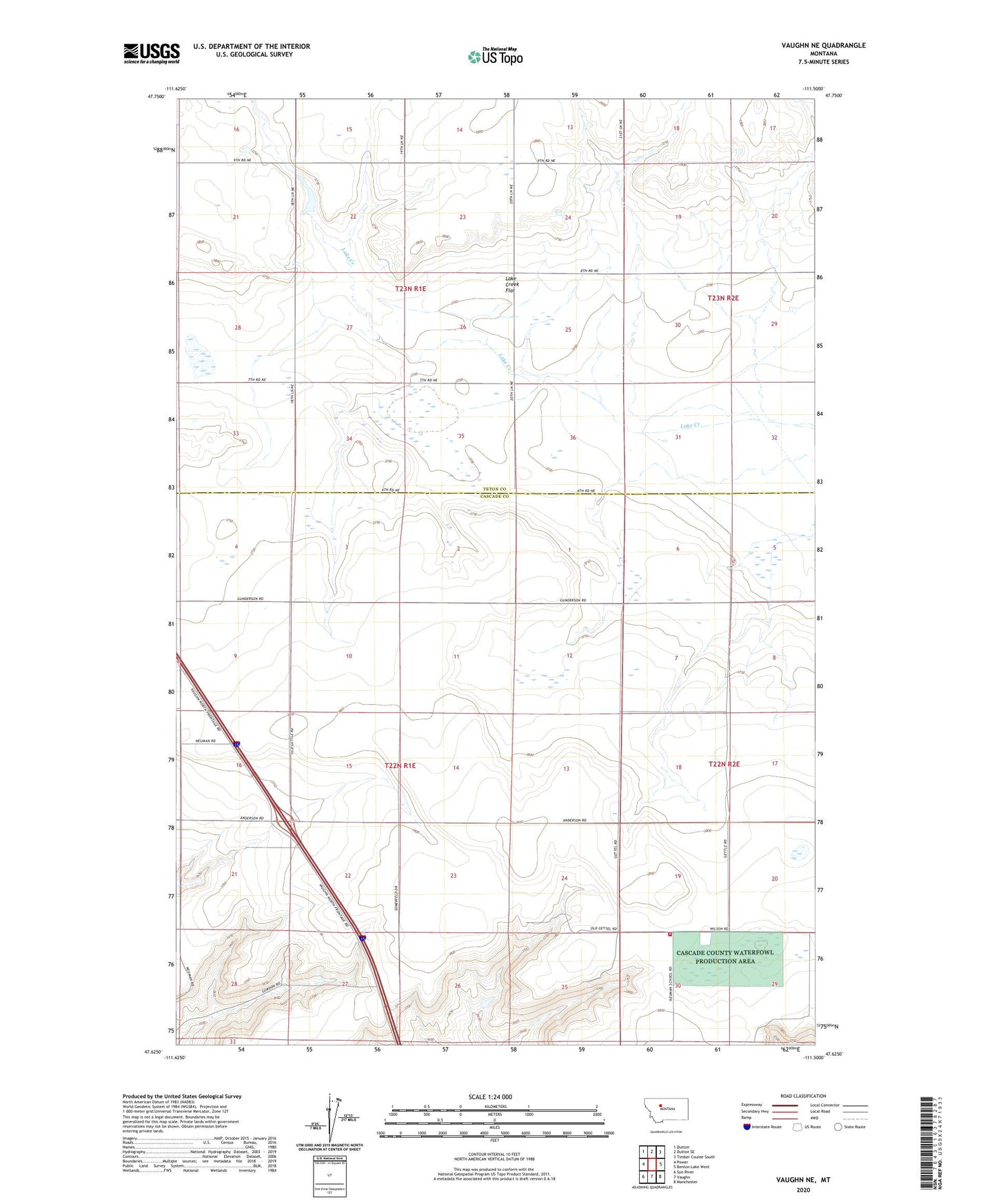
2024 topographic map quadrangle Vaughn NE in the state of Montana. Scale: 1:24000. Based on the newly updated USGS 7.5' US Topo map series, this map is in the following counties: Cascade, Teton. The map contains contour data, water features, and other items you are used to seeing on USGS maps, but also has updated roads and other features. This is the next generation of topographic maps. Printed on high-quality waterproof paper with UV fade-resistant inks.
Quads adjacent to this one:
West: Power
Northwest: Dutton
North: Dutton SE
Northeast: Timber Coulee South
East: Benton Lake West
Southeast: Manchester
South: Vaughn
Southwest: Sun River
This map covers the same area as the classic USGS quad with code o47111f5.
Contains the following named places: 22N01E12AAAA01 Well, 22N01E12AADD01 Well, 22N02E06CCCA01 Well, 22N02E07BBAA01 Well, 22N02E07BCCB01 Well, 22N02E07BCDC01 Well, 22N02E18CDDB01 Well, 23N01E28DADD01 Well, Gettel School, Gunderson Elevator, Lake Creek Flat, Mann School, Muddy Spots Dam, Neuman Number 2 Dam, Neuman School, Rutledge School, Vaughn Volunteer Fire Department - Newman Bench Volunteer Fire Company