MyTopo
Power Montana US Topo Map
Couldn't load pickup availability
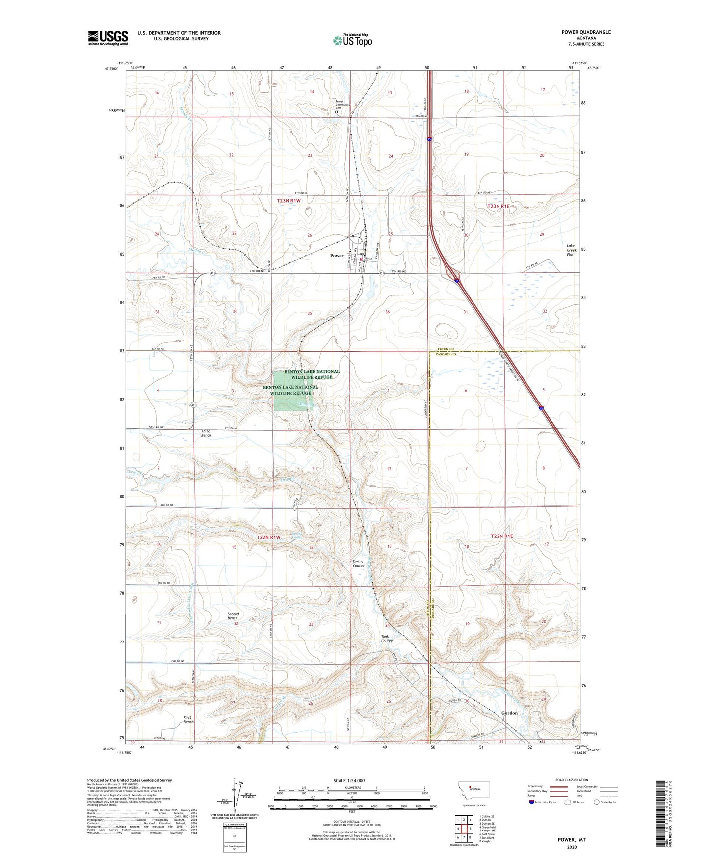
2024 topographic map quadrangle Power in the state of Montana. Scale: 1:24000. Based on the newly updated USGS 7.5' US Topo map series, this map is in the following counties: Teton, Cascade. The map contains contour data, water features, and other items you are used to seeing on USGS maps, but also has updated roads and other features. This is the next generation of topographic maps. Printed on high-quality waterproof paper with UV fade-resistant inks.
Quads adjacent to this one:
West: Greenfield
Northwest: Collins SE
North: Dutton
Northeast: Dutton SE
East: Vaughn NE
Southeast: Vaughn
South: Sun River
Southwest: Fort Shaw
This map covers the same area as the classic USGS quad with code o47111f6.
Contains the following named places: 22N01W09ABB_01 Well, 23N01E32DDBC01 Well, 23N01W22____01 Well, 59468, Drain E, Drain M, Gordon, Gordon School, Guardian Angel Catholic Church, Harvest States Cooperatives Elevator, McIntosh Grain and Feed Incorporated Elevator, Neptune Dam, Power, Power Ambulance, Power Census Designated Place, Power Community Cemetery, Power Farmers Elevator, Power Post Office, Power Public Schools, Power Volunteer Fire Department, Prairie Dell School, Rex, Rocky Mountain Elevator, Spring Coulee, Steel, Tank Coulee, United Church of Christ Congregational, Woodhouse-Lattin Dam, Zion Lutheran Church