
MyTopo
Eagle Buttes Montana US Topo Map
Couldn't load pickup availability
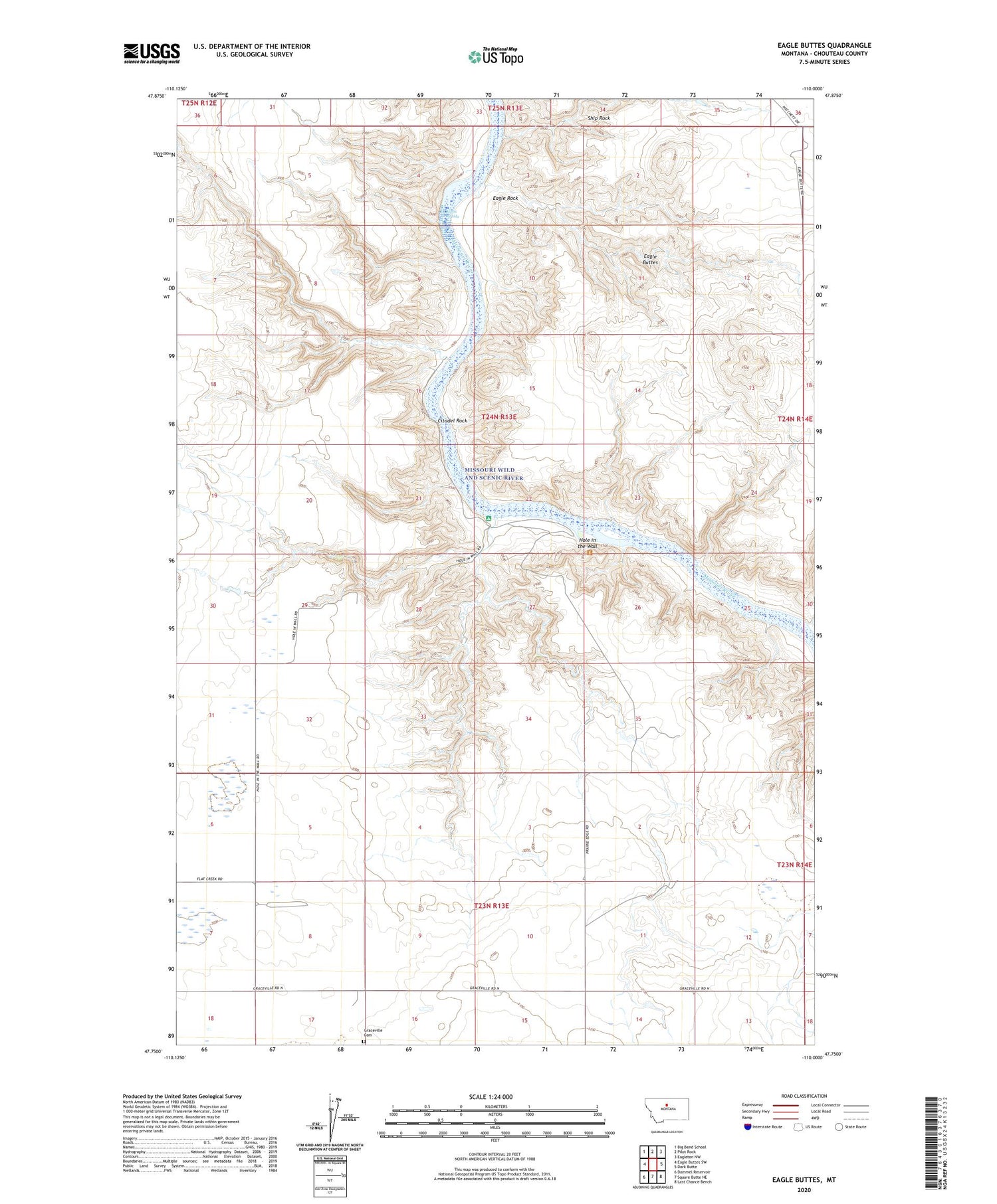
2020 topographic map quadrangle Eagle Buttes in the state of Montana. Scale: 1:24000. Based on the newly updated USGS 7.5' US Topo map series, this map is in the following counties: Chouteau. The map contains contour data, water features, and other items you are used to seeing on USGS maps, but also has updated roads and other features. This is the next generation of topographic maps. Printed on high-quality waterproof paper with UV fade-resistant inks.
Quads adjacent to this one:
West: Eagle Buttes SW
Northwest: Big Bend School
North: Pilot Rock
Northeast: Eagleton NW
East: Dark Butte
Southeast: Last Chance Bench
South: Square Butte NE
Southwest: Dammel Reservoir
Contains the following named places: Butcher Knife Canyon, Citadel Rock, Eagle Buttes, Eagle Rock, Graceville Cemetery, Hole in the Wall, Hole in the Wall Trail, Hole-in-the-Wall, Kipps Rapids, Mud Spring Coulee, Sexton Coal Mines, Sherry Coulee, Ship Rock, Waidman Coal Mine


