
MyTopo
Emerald Lake Montana US Topo Map
Couldn't load pickup availability
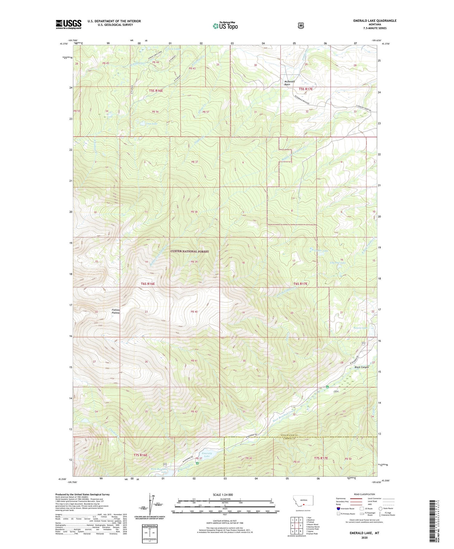
2020 topographic map quadrangle Emerald Lake in the state of Montana. Scale: 1:24000. Based on the newly updated USGS 7.5' US Topo map series, this map is in the following counties: Stillwater, Carbon. The map contains contour data, water features, and other items you are used to seeing on USGS maps, but also has updated roads and other features. This is the next generation of topographic maps. Printed on high-quality waterproof paper with UV fade-resistant inks.
Quads adjacent to this one:
West: Mount Wood
Northwest: Nye
North: Beehive
Northeast: Fishtail
East: Mackay Ranch
Southeast: Sylvan Peak
South: Alpine
Southwest: Granite Peak
Contains the following named places: 06S17E28CDDD01 Well, 06S17E28DCBB01 Well, 07S16E01ACCC01 Well, 59028, Bedford School, Bedfork Ranch, Black Canyon, Cold Creek, Crater Lake, Elbow Creek, Emerald Lake, Emerald Lake Campground, Fishtail Plateau, Has A Name Dam, Hash Ranch, Lily Pad Lake, Line Creek, Lost Lake, McDonald Basin, Pine Grove Campground, Reeves Lake, Rickman-Kennedy Ditch, Twin Lakes, West Rosebud Lake, West Rosebud Lake Dam


