MyTopo
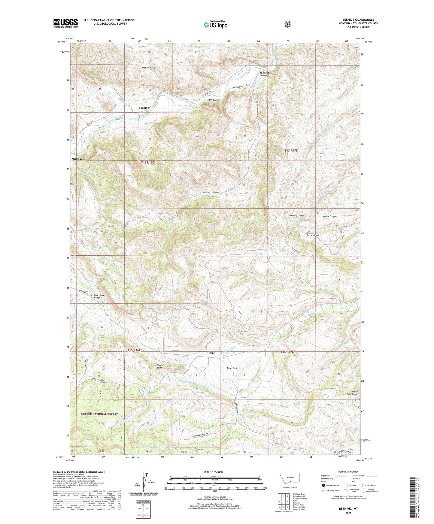
Beehive Montana US Topo Map
Couldn't load pickup availability
Also explore the Beehive Forest Service Topo of this same quad for updated USFS data
2024 topographic map quadrangle Beehive in the state of Montana. Scale: 1:24000. Based on the newly updated USGS 7.5' US Topo map series, this map is in the following counties: Stillwater. The map contains contour data, water features, and other items you are used to seeing on USGS maps, but also has updated roads and other features. This is the next generation of topographic maps. Printed on high-quality waterproof paper with UV fade-resistant inks.
Quads adjacent to this one:
West: Nye
Northwest: Wildcat Draw
North: Cow Face Hill
Northeast: Sandborn Creek
East: Fishtail
Southeast: Mackay Ranch
South: Emerald Lake
Southwest: Mount Wood
This map covers the same area as the classic USGS quad with code o45109d6.
Contains the following named places: 04S16E14DCAB01 Well, 04S16E22CABB01 Well, 04S16E23BABA01 Well, 04S17E07DCDD01 Well, 04S17E08CCAC01 Well, 04S17E18AABB01 Well, 04S17E18AADD01 Well, 04S17E18ACAD01 Well, 05S16E03BDCC01 Spring, 05S16E13AACB01 Well, 05S16E14CDBC01 Well, 05S16E24CDDA01 Well, Bad Canyon Creek, Beehive, Beehive Post Office, Beehive Rock, Beehive School, Castle Rock Campground, Castle Rock Fishing Access Site, Dale Creek, Dale Creek Bridge, Dark Canyon, Dean, Dean Basin, Dean Post Office, East Fishtail Creek, Fishtail Butte, Heart Lake, Island Lake, Lewis-Hudson-Fowler Ditch, Magpie Canyon, Meadow Creek, Midnight Canyon, Midnight Creek, Sheep Creek, West Fishtail Creek