MyTopo
Flag Butte Montana US Topo Map
Couldn't load pickup availability
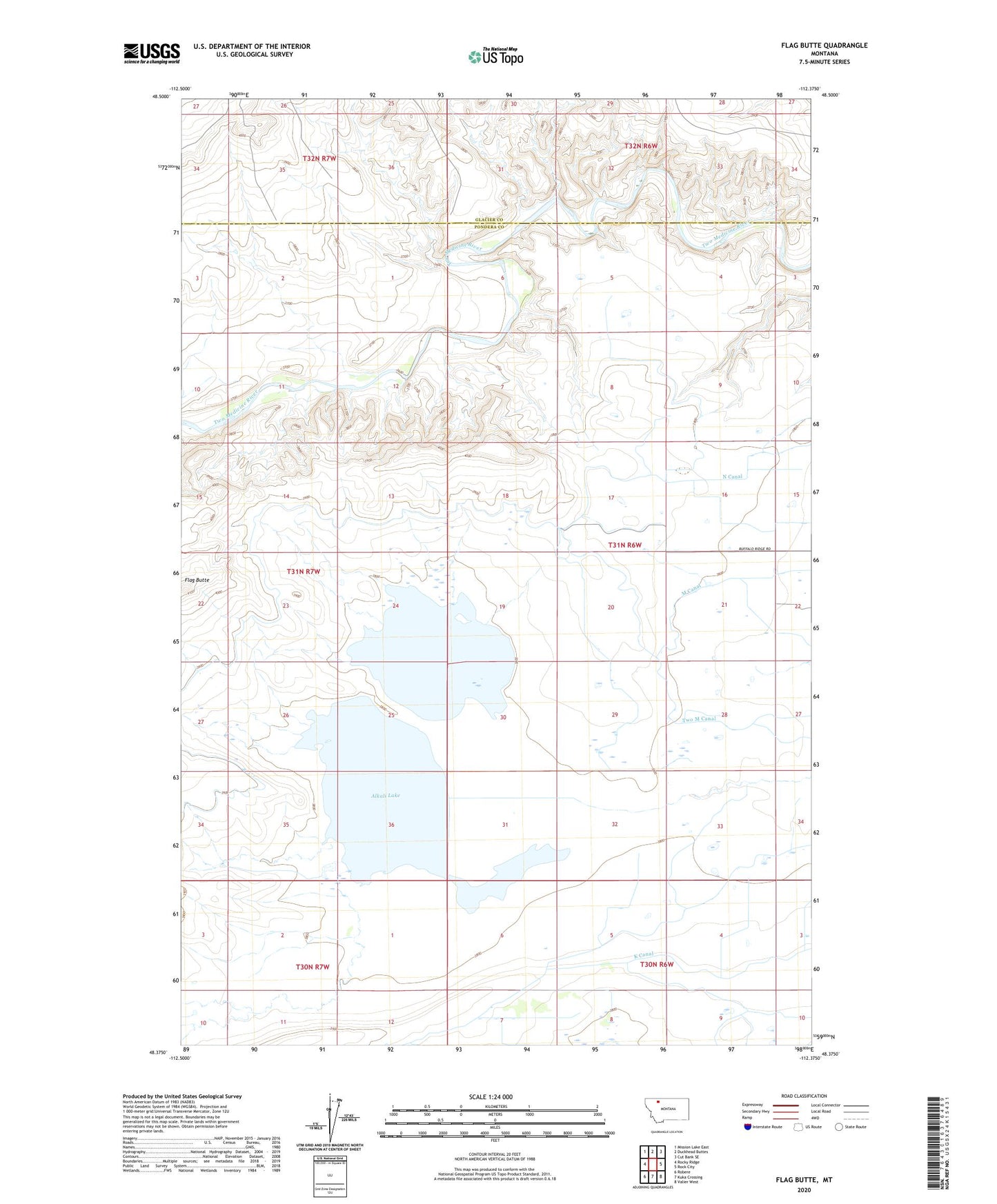
2020 topographic map quadrangle Flag Butte in the state of Montana. Scale: 1:24000. Based on the newly updated USGS 7.5' US Topo map series, this map is in the following counties: Pondera, Glacier. The map contains contour data, water features, and other items you are used to seeing on USGS maps, but also has updated roads and other features. This is the next generation of topographic maps. Printed on high-quality waterproof paper with UV fade-resistant inks.
Quads adjacent to this one:
West: Rocky Ridge
Northwest: Mission Lake East
North: Duckhead Buttes
Northeast: Cut Bank SE
East: Rock City
Southeast: Valier West
South: Kuka Crossing
Southwest: Robere
Contains the following named places: Alkali Lake, Badger Fisher Main Canal, Bird Ranch, Blackfeet Reservation East Division, Edwards Crossing, Flag Butte, Kimball Mine, Lateral K, M Canal, N Canal, Wagner Ranch