MyTopo
Mission Lake East Montana US Topo Map
Couldn't load pickup availability
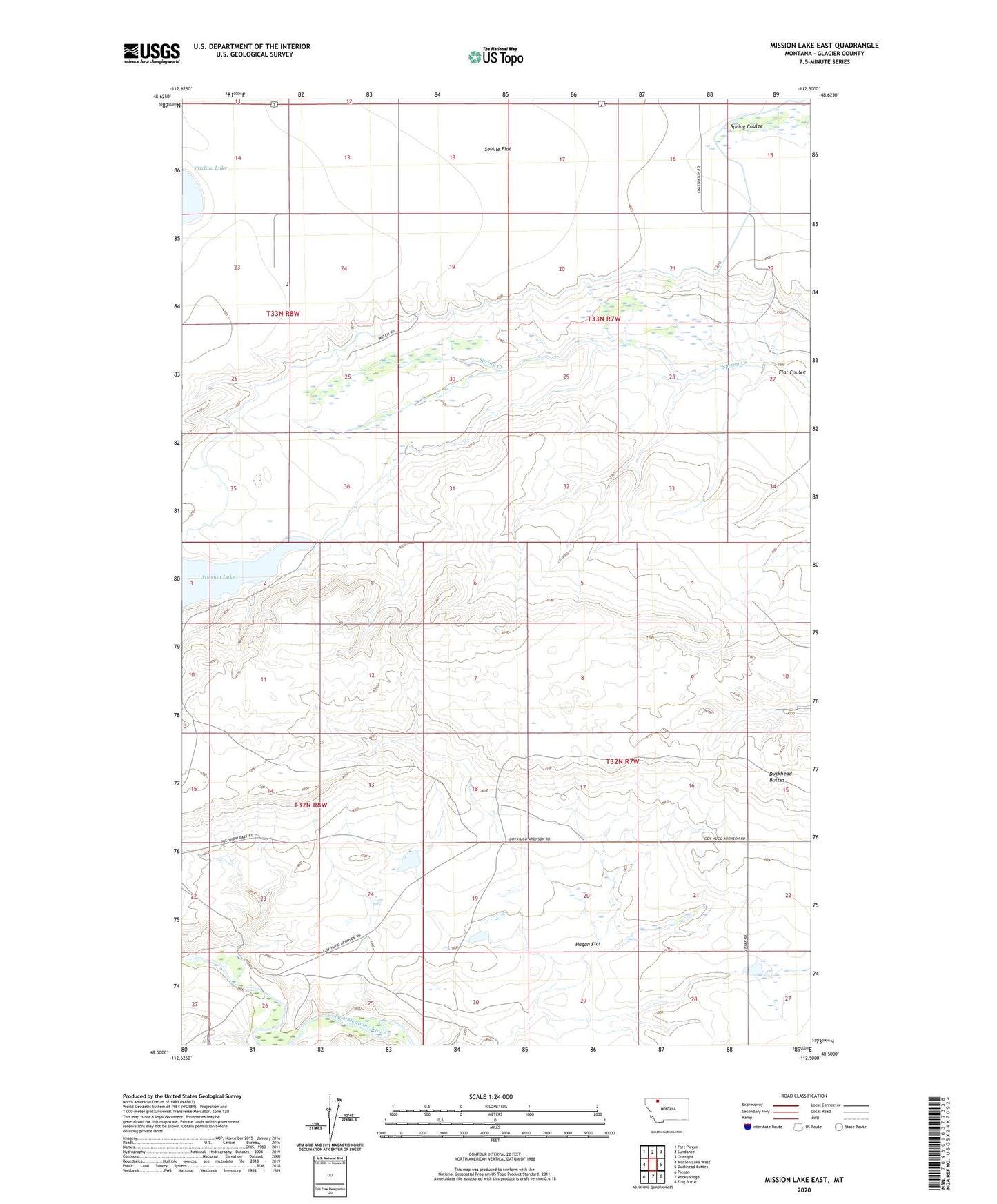
2024 topographic map quadrangle Mission Lake East in the state of Montana. Scale: 1:24000. Based on the newly updated USGS 7.5' US Topo map series, this map is in the following counties: Glacier. The map contains contour data, water features, and other items you are used to seeing on USGS maps, but also has updated roads and other features. This is the next generation of topographic maps. Printed on high-quality waterproof paper with UV fade-resistant inks.
Quads adjacent to this one:
West: Mission Lake West
Northwest: Fort Piegan
North: Sundance
Northeast: Gunsight
East: Duckhead Buttes
Southeast: Flag Butte
South: Rocky Ridge
Southwest: Piegan
This map covers the same area as the classic USGS quad with code o48112e5.
Contains the following named places: 33N07W22BBDA01 Well, Carlow Lake, Duckhead Buttes, Hagan Flat, Hidden Lake Colony, Hidden Lake Colony Census Designated Place, Mission Lake Dam, Seville Flat, Sunny Mountains Dam