MyTopo
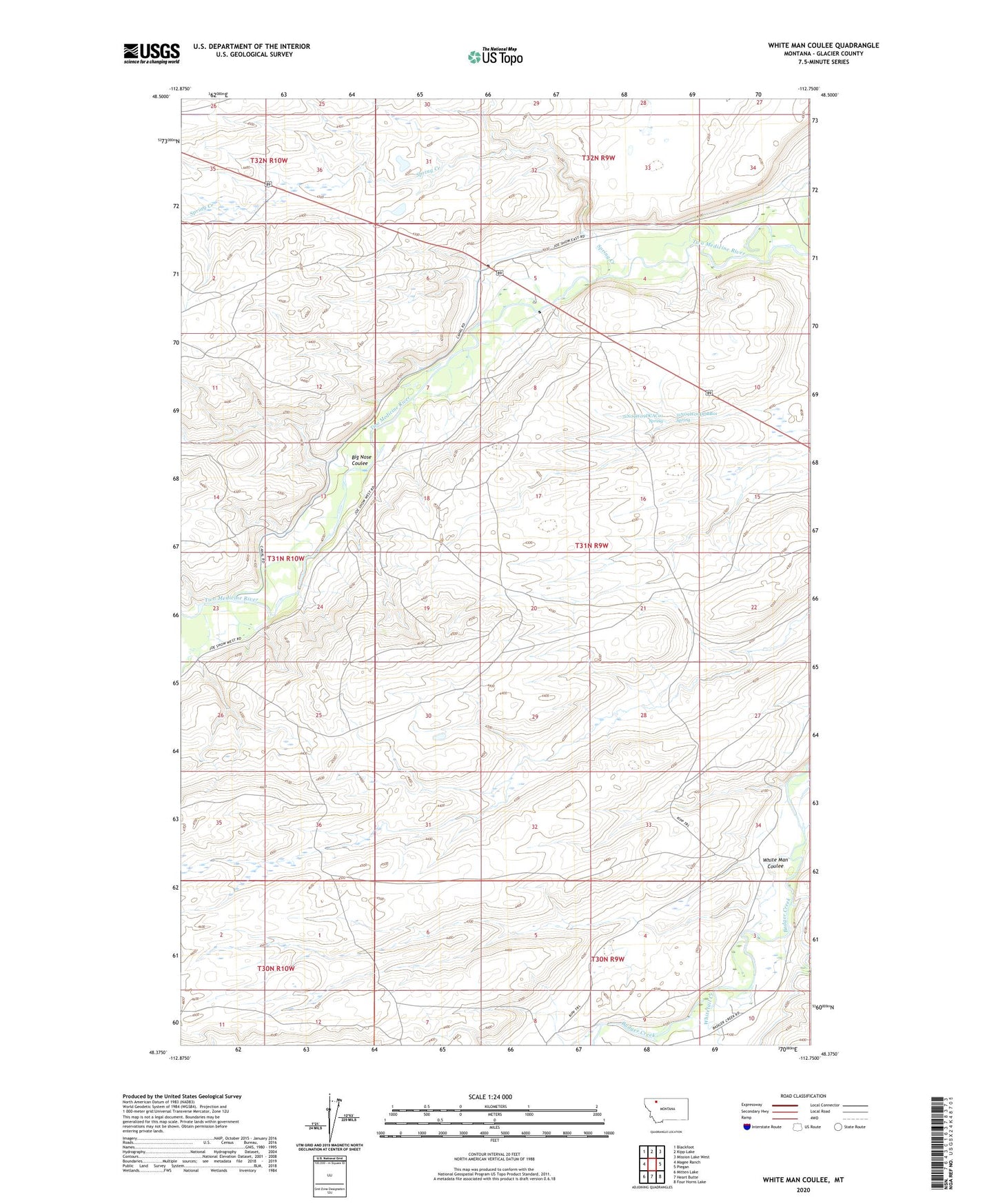
White Man Coulee Montana US Topo Map
Couldn't load pickup availability
2024 topographic map quadrangle White Man Coulee in the state of Montana. Scale: 1:24000. Based on the newly updated USGS 7.5' US Topo map series, this map is in the following counties: Glacier. The map contains contour data, water features, and other items you are used to seeing on USGS maps, but also has updated roads and other features. This is the next generation of topographic maps. Printed on high-quality waterproof paper with UV fade-resistant inks.
Quads adjacent to this one:
West: Magee Ranch
Northwest: Blackfoot
North: Kipp Lake
Northeast: Mission Lake West
East: Piegan
Southeast: Four Horns Lake
South: Heart Butte
Southwest: Mitten Lake
This map covers the same area as the classic USGS quad with code o48112d7.
Contains the following named places: 31N09W09DCAC01 Spring, 31N09W09DDBB01 Spring, Bakers Post, Big Nose Coulee, Little Badger Creek, Powers Post, Running Crane Blackfeet Agency, Spring Creek, Two Medicine Community Center, White Man Coulee, Whitetail Creek