MyTopo
Fowler Coulee NW Montana US Topo Map
Couldn't load pickup availability
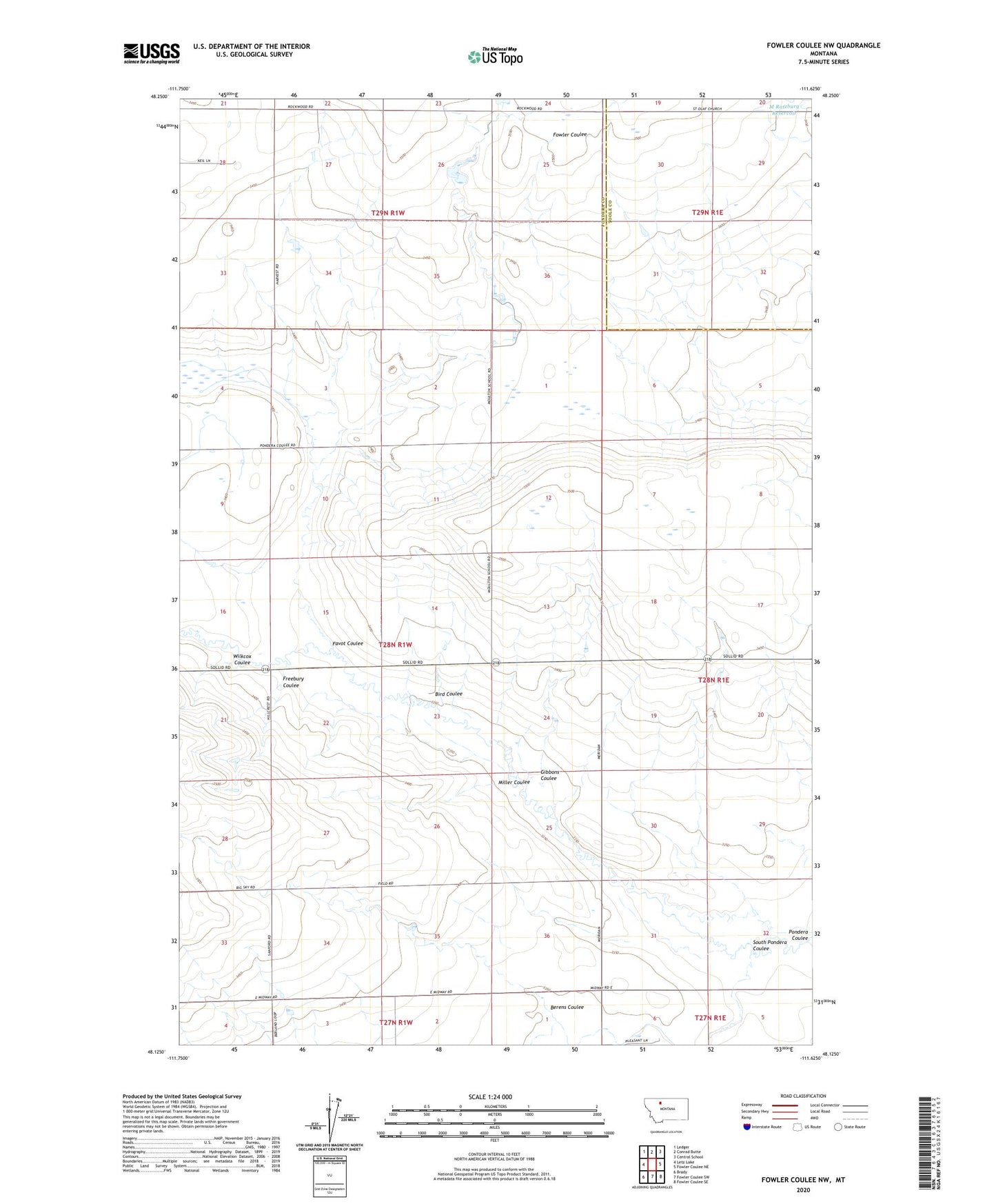
2020 topographic map quadrangle Fowler Coulee NW in the state of Montana. Scale: 1:24000. Based on the newly updated USGS 7.5' US Topo map series, this map is in the following counties: Pondera, Toole. The map contains contour data, water features, and other items you are used to seeing on USGS maps, but also has updated roads and other features. This is the next generation of topographic maps. Printed on high-quality waterproof paper with UV fade-resistant inks.
Quads adjacent to this one:
West: Letz Lake
Northwest: Ledger
North: Conrad Butte
Northeast: Central School
East: Fowler Coulee NE
Southeast: Fowler Coulee SE
South: Fowler Coulee SW
Southwest: Brady
Contains the following named places: 28N01W36ADBC01 Well, Berens Coulee, Bergstroms Farms Dam, Bergstroms Farms Number 2 Dam, Bird Coulee, Dato Dam, Favot Coulee, Freebury Coulee, Gibbons Coulee, Harold Phillips Dam, M Ratzburg Dam, Miller Coulee, South Pondera Coulee, Wilkcox Coulee