MyTopo
Ledger Montana US Topo Map
Couldn't load pickup availability
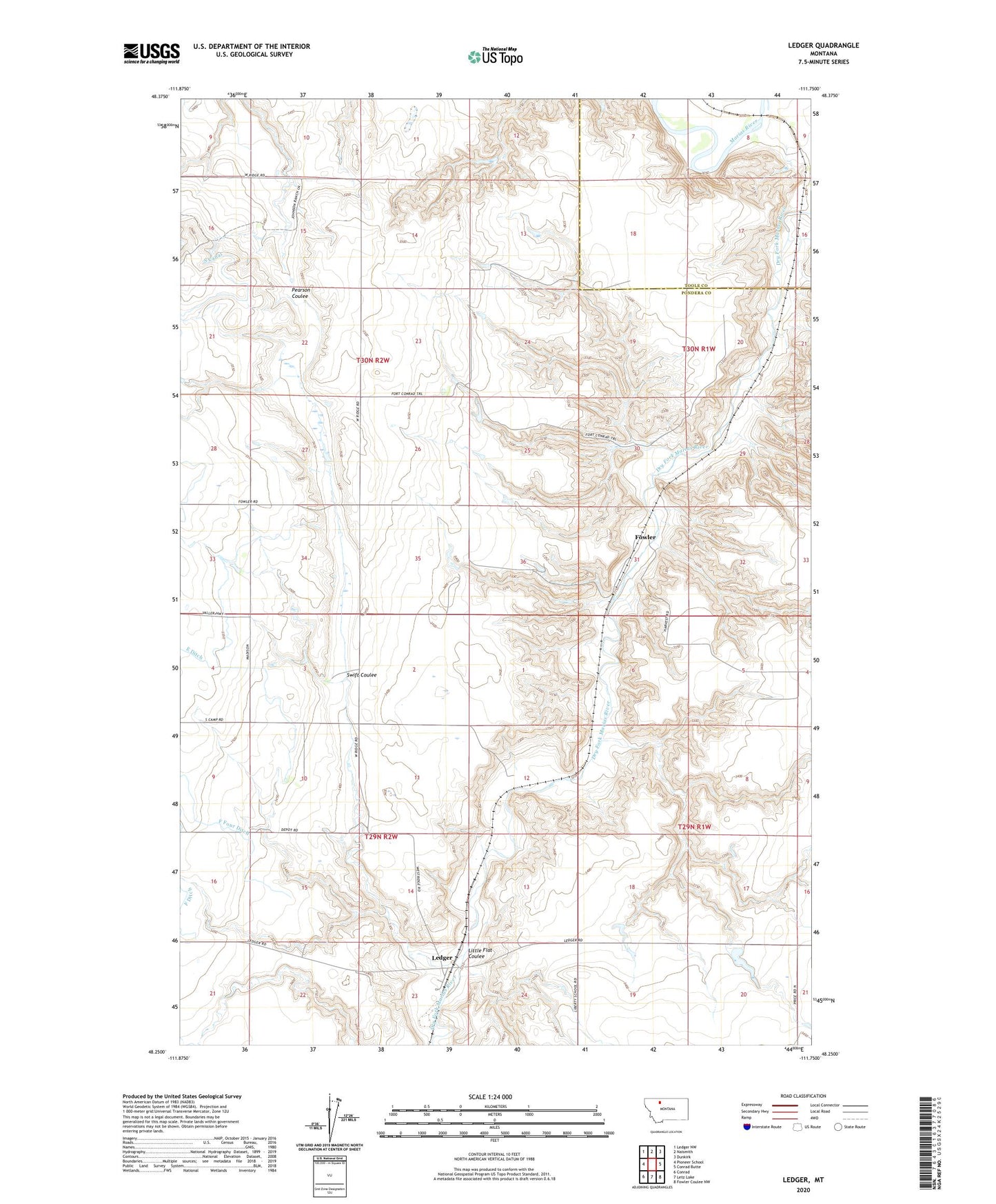
2024 topographic map quadrangle Ledger in the state of Montana. Scale: 1:24000. Based on the newly updated USGS 7.5' US Topo map series, this map is in the following counties: Pondera, Toole. The map contains contour data, water features, and other items you are used to seeing on USGS maps, but also has updated roads and other features. This is the next generation of topographic maps. Printed on high-quality waterproof paper with UV fade-resistant inks.
Quads adjacent to this one:
West: Pioneer School
Northwest: Ledger NW
North: Naismith
Northeast: Dunkirk
East: Conrad Butte
Southeast: Fowler Coulee NW
South: Letz Lake
Southwest: Conrad
This map covers the same area as the classic USGS quad with code o48111c7.
Contains the following named places: Columbia Grain International Incorporated Elevator, Conrad, Conrad Post Office, Cracker Dam, F Four Ditch, Fort Conrad, Fort Conrad Historical Monument, Fowler, Fowler Post Office, Fowler School, Keil Ranch, Ledger, Ledger Post Office, Ledger School, Little Flat Coulee, S Canal, Saint Olaf Lutheran Church, Swift Coulee, Tom McCracken Dam