
MyTopo
Frank Coulee Montana US Topo Map
Couldn't load pickup availability
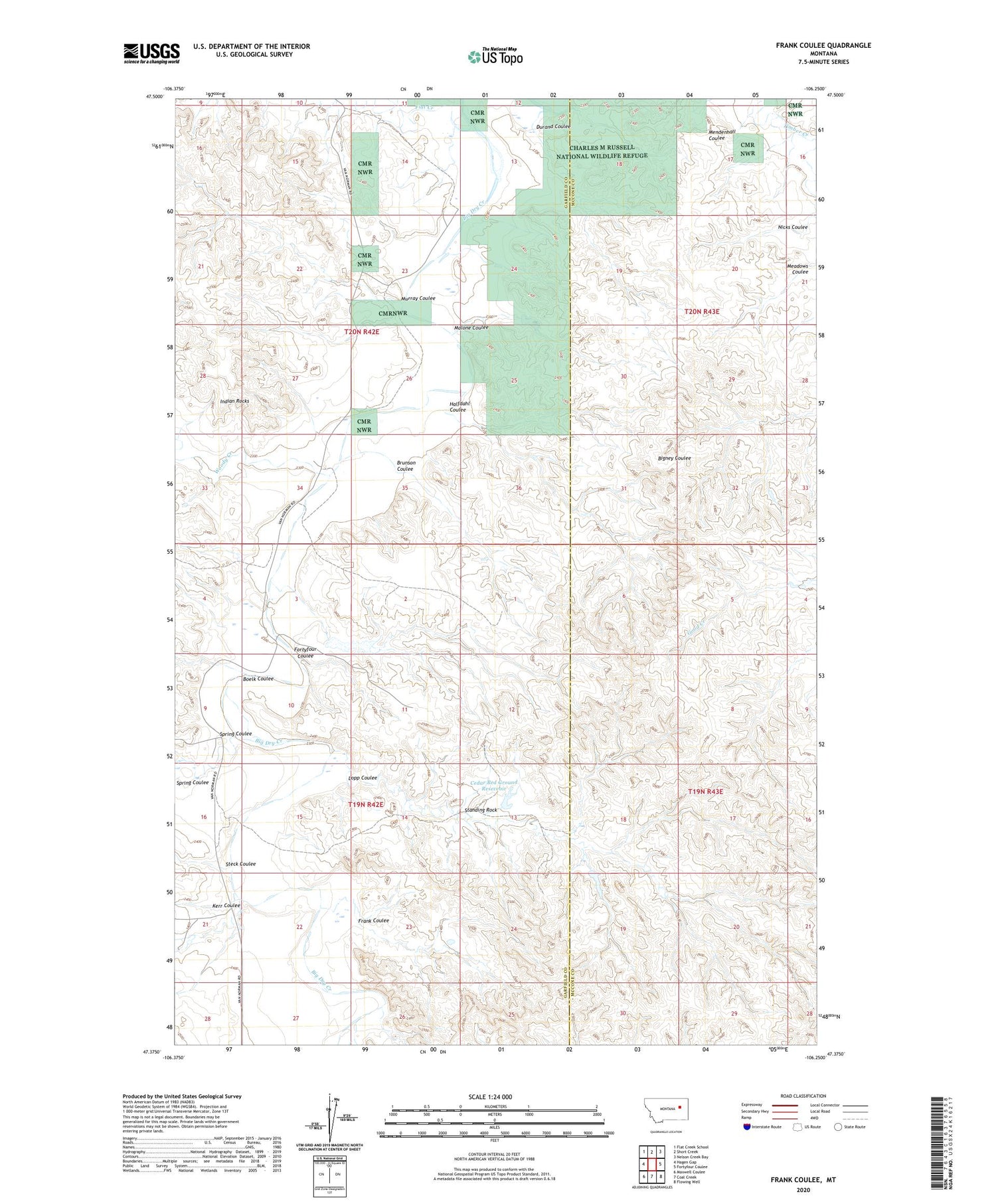
2020 topographic map quadrangle Frank Coulee in the state of Montana. Scale: 1:24000. Based on the newly updated USGS 7.5' US Topo map series, this map is in the following counties: Garfield, McCone. The map contains contour data, water features, and other items you are used to seeing on USGS maps, but also has updated roads and other features. This is the next generation of topographic maps. Printed on high-quality waterproof paper with UV fade-resistant inks.
Quads adjacent to this one:
West: Hagen Gap
Northwest: Flat Creek School
North: Short Creek
Northeast: Nelson Creek Bay
East: Fortyfour Coulee
Southeast: Flowing Well
South: Coal Creek
Southwest: Maxwell Coulee
Contains the following named places: 19N42E03B___01 Well, 19N42E03BB__01 Well, 19N42E03C___01 Well, 19N42E09A___01 Well, 19N42E09AAAD01 Well, 19N42E10C___01 Well, 19N42E14AD__01 Well, 19N42E21A___01 Well, 19N42E26B___01 Well, 19N42E27ADBB01 Well, 20N42E14D___01 Well, 20N42E22CA__01 Well, 20N42E23AB__01 Well, 20N42E34A___01 Well, 20N42E34AB__01 Well, 20N42E34AC__01 Well, 20N42E34CA__01 Well, Billings Number 3 Dam, Boelk Coulee, Boelk Well, Brunson Coulee, Cedar Bed Ground Reservoir, Durand Coulee, Flat Creek, Fortyfour Coulee, Frank Coulee, Halfdahl Coulee, Indian Rocks, Kerr Coulee, Lopp Coulee, Malone Coulee, McKerlic Number 1 Dam, Meadows Coulee, Murray Coulee, Nicks Coulee, Spring Coulee, Standing Rock, Steck Coulee, Van Norman School, Woody Creek


