
MyTopo
Frog Coulee Montana US Topo Map
Couldn't load pickup availability
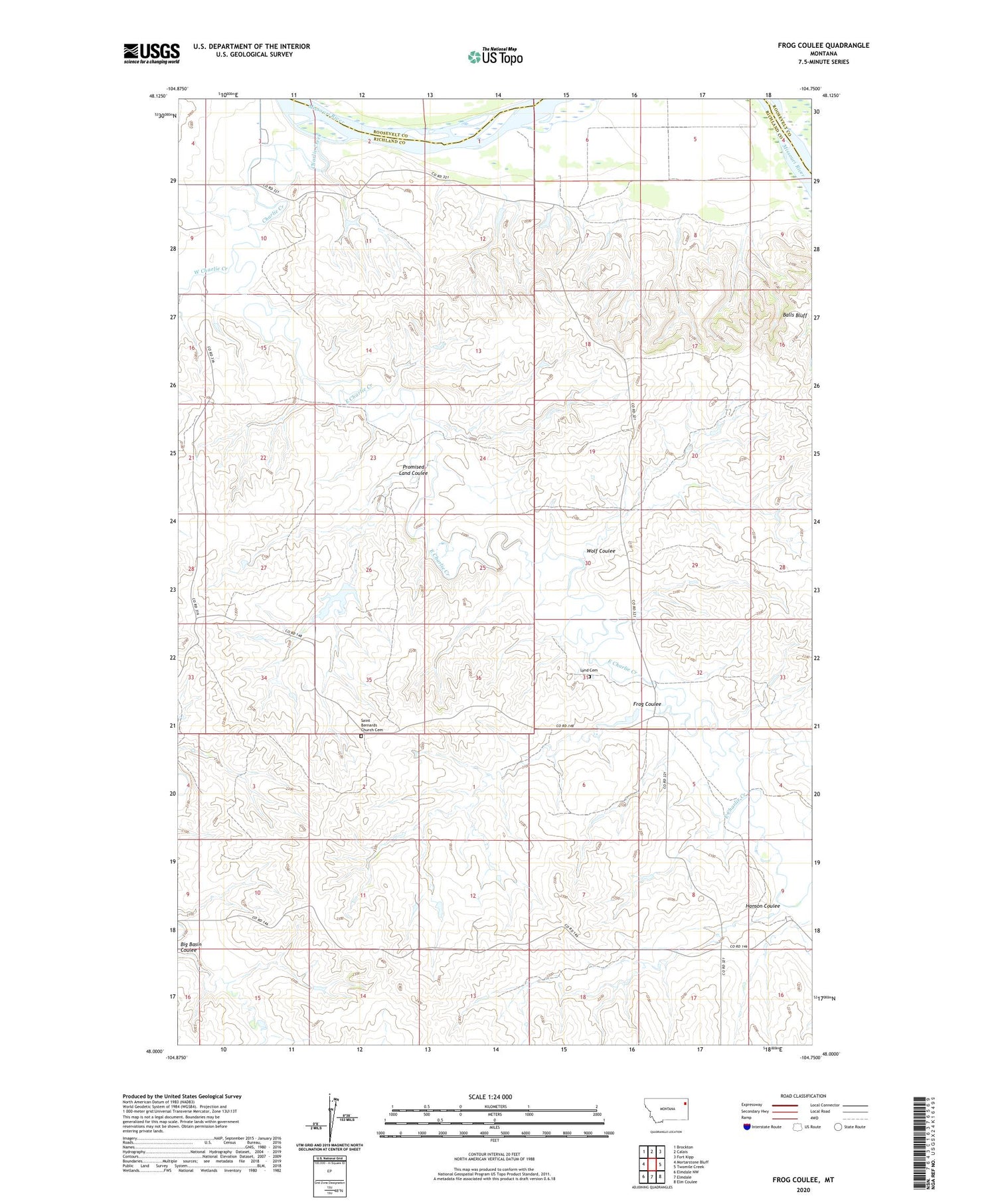
2020 topographic map quadrangle Frog Coulee in the state of Montana. Scale: 1:24000. Based on the newly updated USGS 7.5' US Topo map series, this map is in the following counties: Richland, Roosevelt. The map contains contour data, water features, and other items you are used to seeing on USGS maps, but also has updated roads and other features. This is the next generation of topographic maps. Printed on high-quality waterproof paper with UV fade-resistant inks.
Quads adjacent to this one:
West: Mortarstone Bluff
Northwest: Brockton
North: Calais
Northeast: Fort Kipp
East: Twomile Creek
Southeast: Elm Coulee
South: Elmdale
Southwest: Elmdale NW
Contains the following named places: 26N54E09CACA01 Well, 26N54E17DCAA01 Well, 27N53E01CC__01 Well, 27N53E01CD__01 Well, 27N53E03DBAA01 Well, 27N53E09DD__01 Well, 27N53E09DD__02 Well, 27N53E10BC__01 Well, 27N53E10BC__02 Well, 27N53E10CC__01 Well, 27N53E12AB__01 Well, 27N53E34AAAA01 Well, 27N54E07BA__01 Well, 27N54E07BA__02 Well, 27N54E07BB__01 Well, 27N54E07BD__01 Well, 27N54E08BD__01 Well, 27N54E08CC__01 Well, 27N54E08CC__02 Well, 27N54E09BB__01 Well, 27N54E09BC__01 Well, Balls Bluff, Charlie Creek, East Charlie Creek, Foss Dam, Foss Farms Number 3 Dam, Frog Coulee, Hanson Coulee, Harfo Dam, Lynd Cemetery, Promised Land Coulee, R Schmitz Number 1 Dam, Saint Bernards Church, Saint Bernards Church Cemetery, West Charlie Creek, Wolf Coulee


