MyTopo
Twomile Creek Montana US Topo Map
Couldn't load pickup availability
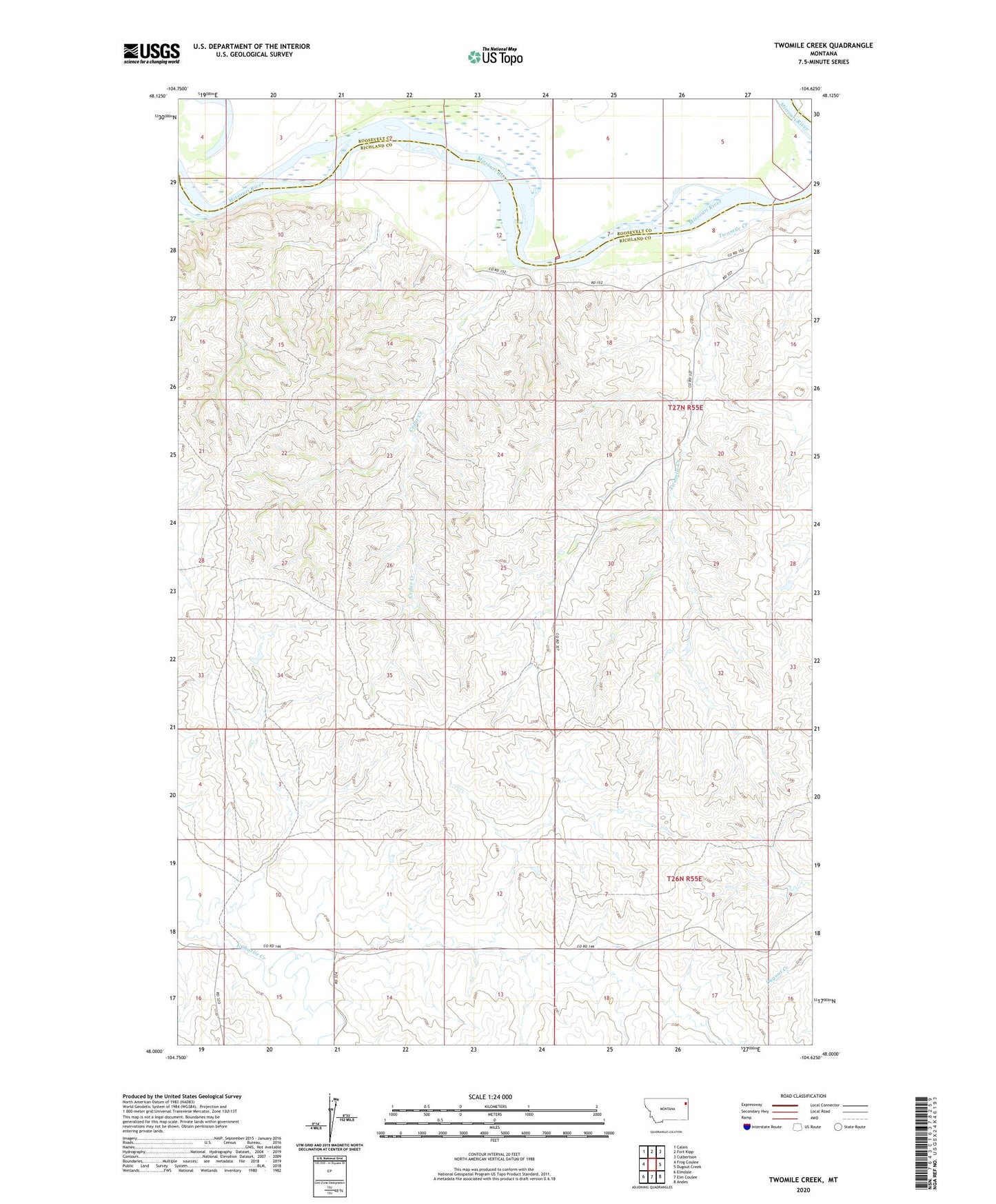
2024 topographic map quadrangle Twomile Creek in the state of Montana. Scale: 1:24000. Based on the newly updated USGS 7.5' US Topo map series, this map is in the following counties: Richland, Roosevelt. The map contains contour data, water features, and other items you are used to seeing on USGS maps, but also has updated roads and other features. This is the next generation of topographic maps. Printed on high-quality waterproof paper with UV fade-resistant inks.
Quads adjacent to this one:
West: Frog Coulee
Northwest: Calais
North: Fort Kipp
Northeast: Culbertson
East: Dugout Creek
Southeast: Andes
South: Elm Coulee
Southwest: Elmdale
This map covers the same area as the classic USGS quad with code o48104a6.
Contains the following named places: 26N54E03DCAB01 Well, 26N55E06CBCD01 Well, 27N54E12CC__01 Well, 27N54E12CCAC01 Well, 27N54E12CCAD01 Well, 27N55E17BB__01 Well, C Sowle Reservoir Dam, Cedar Creek, Fort Stewart, Juniors Place Dam, Twomile Creek