MyTopo
Elmdale Montana US Topo Map
Couldn't load pickup availability
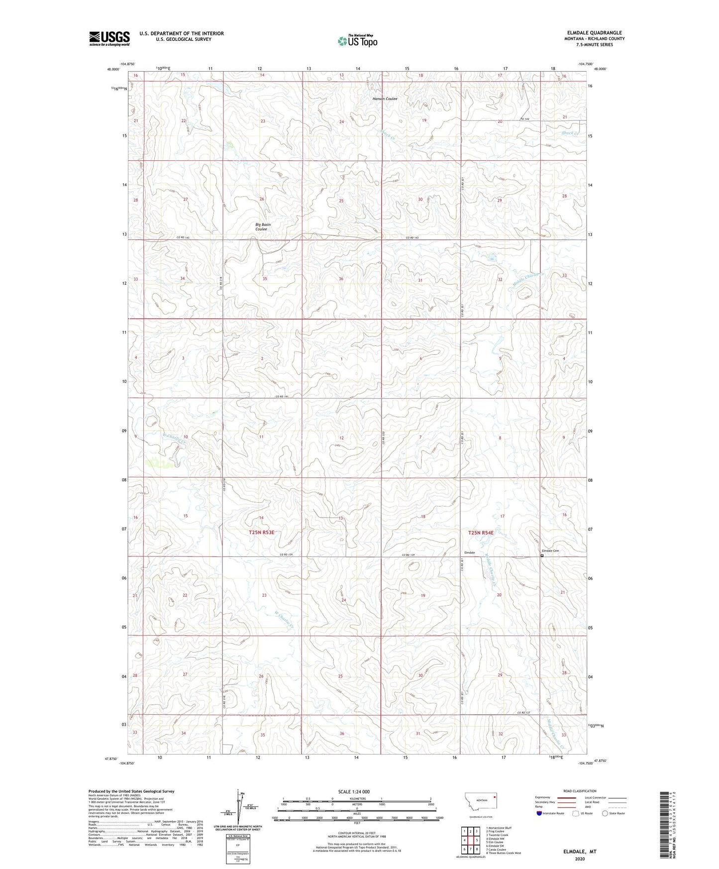
2024 topographic map quadrangle Elmdale in the state of Montana. Scale: 1:24000. Based on the newly updated USGS 7.5' US Topo map series, this map is in the following counties: Richland. The map contains contour data, water features, and other items you are used to seeing on USGS maps, but also has updated roads and other features. This is the next generation of topographic maps. Printed on high-quality waterproof paper with UV fade-resistant inks.
Quads adjacent to this one:
West: Elmdale NW
Northwest: Mortarstone Bluff
North: Frog Coulee
Northeast: Twomile Creek
East: Elm Coulee
Southeast: Three Buttes Creek West
South: Carda Coulee
Southwest: Elmdale SW
This map covers the same area as the classic USGS quad with code o47104h7.
Contains the following named places: 25N54E19BBCA01 Well, 25N54E30DA__01 Well, 26N53E25AAC_01 Well, 26N53E26BBAC01 Well, Bottens School, Elmdale, Elmdale Cemetery, Elmdale Post Office, Elmdale School, Golden Dam