MyTopo
Gage Montana US Topo Map
Couldn't load pickup availability
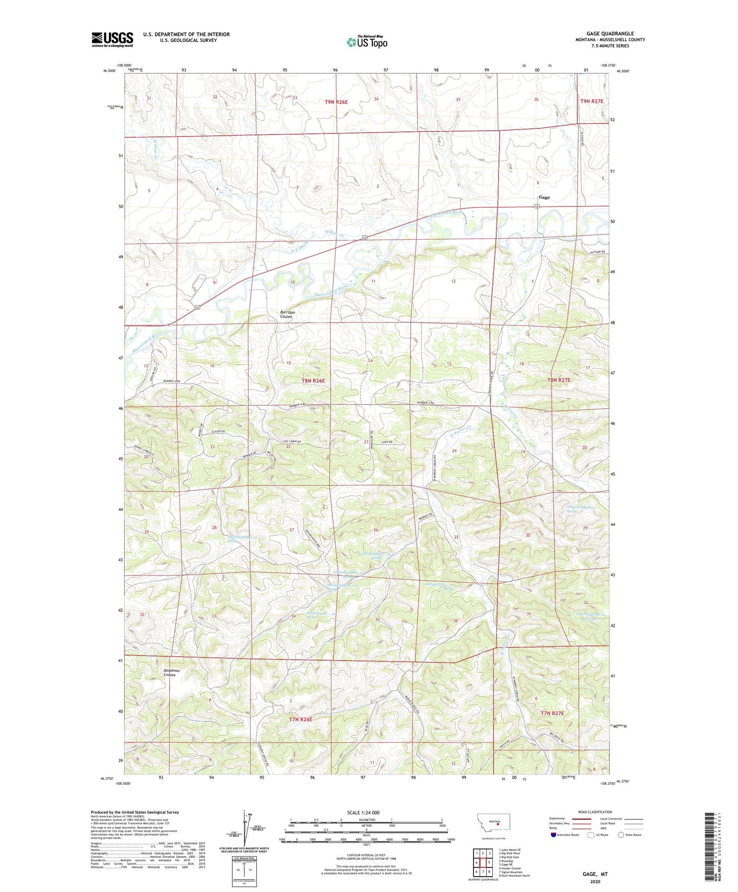
2024 topographic map quadrangle Gage in the state of Montana. Scale: 1:24000. Based on the newly updated USGS 7.5' US Topo map series, this map is in the following counties: Musselshell. The map contains contour data, water features, and other items you are used to seeing on USGS maps, but also has updated roads and other features. This is the next generation of topographic maps. Printed on high-quality waterproof paper with UV fade-resistant inks.
Quads adjacent to this one:
West: Roundup
Northwest: Lake Mason SE
North: Big Wall West
Northeast: Big Wall East
East: Gage NE
Southeast: Dunn Mountain North
South: Signal Mountain
Southwest: Harper Coulee
This map covers the same area as the classic USGS quad with code o46108d4.
Contains the following named places: 07N26E02ADCB01 Well, 07N26E03DADA01 Well, 07N26E03DBDA01 Well, 07N26E04AABC01 Well, 07N26E04CDBA01 Well, 07N27E06CBBB01 Well, 07N27E06CCB_01 Well, 07N27E06DCBC01 Well, 07N27E06DDDD01 Well, 08N26E10BBBB01 Well, 08N26E25BACC01 Well, 08N26E25BBDA01 Well, 08N26E25CA__01 Spring, 08N26E25DB__01 Well, 08N26E26DBAD01 Well, 08N26E26DCC_01 Spring, 08N26E27BA__01 Well, 08N26E28CD__01 Well, 08N26E28CDCA01 Well, 08N26E28DB__01 Spring, 08N26E32AAAA01 Well, 08N26E34AC__01 Spring, 08N26E34ADA_01 Spring, 08N26E34ADB_01 Well, 08N26E34CAA_01 Well, 08N26E34DDC_01 Well, 08N26E35BBA_01 Spring, 08N27E29BCA_01 Spring, 08N27E31CCBD01 Well, 08N27E32CDB_01 Spring, Barrigan Coulee, Blue Streak Downs, Davisten, East Parrot Creek, Gage, Gage Post Office, Jeffries Mine, Musselshell County, N-F Ditch, Number 4 Mine, Parrot Creek, West Parrot Creek, Western Mine, Willow Creek