MyTopo
Garrison Montana US Topo Map
Couldn't load pickup availability
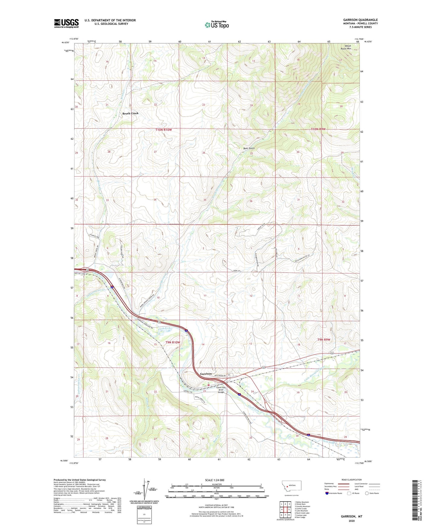
2020 topographic map quadrangle Garrison in the state of Montana. Scale: 1:24000. Based on the newly updated USGS 7.5' US Topo map series, this map is in the following counties: Powell. The map contains contour data, water features, and other items you are used to seeing on USGS maps, but also has updated roads and other features. This is the next generation of topographic maps. Printed on high-quality waterproof paper with UV fade-resistant inks.
Quads adjacent to this one:
West: Griffin Creek
Northwest: Bailey Mountain
North: Windy Rock
Northeast: Gravely Mountain
East: Luke Mountain
Southeast: Deer Lodge
South: Conleys Lake
Southwest: Rock Creek Lake
Contains the following named places: 09N10W04BDBC01 Well, 09N10W04BDBC02 Well, 09N10W04CACC01 Well, 09N10W04CDBB01 Well, 09N10W04CDBB02 Well, 09N10W05DDDA01 Well, 09N10W05DDDA02 Well, 09N10W08AADA01 Well, 09N10W10CCAD01 Well, 09N10W10CDBD01 Well, 09N10W10CDCC01 Well, 09N10W14DDCD01 Well, 09N10W15AABB01 Well, 09N10W15BABC01 Well, 09N10W15BABD01 Well, 09N10W15BACA01 Well, 09N10W15BBAB01 Well, 09N10W22ABAB01 Well, 09N10W22DAAD01 Well, 09N10W23AADD01 Well, 09N10W23ACBD01 Well, 09N10W23ACDD01 Well, 09N10W23ADCC01 Well, 09N10W23BDAD01 Well, 09N10W23CAAD01 Well, 09N10W23CCAA01 Well, 09N10W24ABCA01 Well, 09N10W24ABCD01 Well, 09N10W24BABC01 Well, 09N10W24BBBD01 Well, 09N10W24BBCA01 Well, 09N10W24BBCA02 Well, 09N10W24BBCC01 Well, 09N10W24BBDA01 Well, 09N10W24BBDB01 Well, 09N10W24BBDC01 Well, 59731, Bear Gulch, Brock Creek, Clark Fork River Bridge, Garrison, Garrison Census Designated Place, Garrison Elementary School, Garrison Post Office, Garrison Volunteer Fire Department, Independence Creek, Little Blackfoot River, Phosphate, Riverfront RV Park, Rock Creek, Warm Springs Creek, Willow Creek