MyTopo
Rock Creek Lake Montana US Topo Map
Couldn't load pickup availability
Also explore the Rock Creek Lake Forest Service Topo of this same quad for updated USFS data
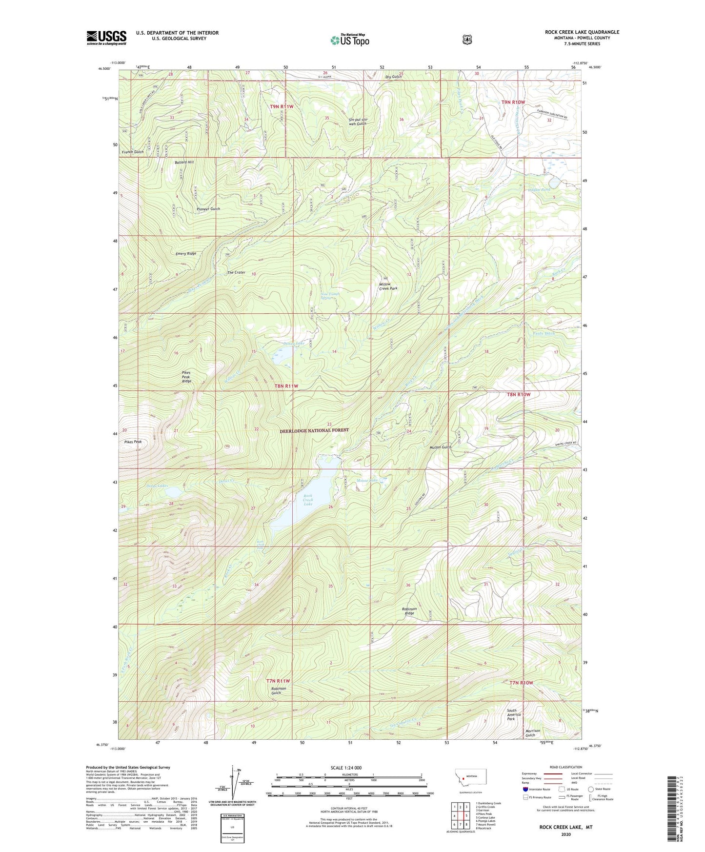
2024 topographic map quadrangle Rock Creek Lake in the state of Montana. Scale: 1:24000. Based on the newly updated USGS 7.5' US Topo map series, this map is in the following counties: Powell. The map contains contour data, water features, and other items you are used to seeing on USGS maps, but also has updated roads and other features. This is the next generation of topographic maps. Printed on high-quality waterproof paper with UV fade-resistant inks.
Quads adjacent to this one:
West: Pikes Peak
Northwest: Dunkleberg Creek
North: Griffin Creek
Northeast: Garrison
East: Conleys Lake
Southeast: Racetrack
South: Mount Powell
Southwest: Pozega Lakes
This map covers the same area as the classic USGS quad with code o46112d8.
Contains the following named places: Ballard Hill, Dolus Creek, Dolus Lakes, Doney Lake, Doney Lake Dam, Hagan Pond, Kohrs and Bielenberg Ditch, Moose Lake, Nine Trough Spring, Old China Ditch, Robinson Ridge, Rock Creek Falls, Rock Creek Lake, Rock Creek Lake Dam, South America Park, South Fork Rock Creek, The Crater, Willow Creek Park, ZIP Code: 59733