MyTopo
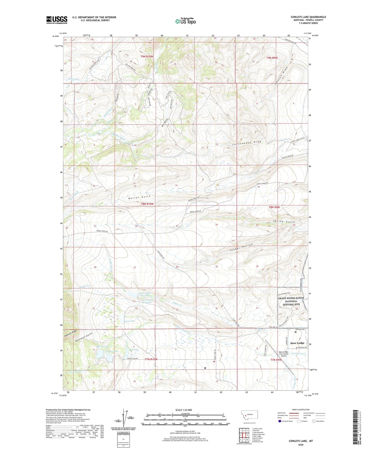
Conleys Lake Montana US Topo Map
Couldn't load pickup availability
Also explore the Conleys Lake Forest Service Topo of this same quad for updated USFS data
2024 topographic map quadrangle Conleys Lake in the state of Montana. Scale: 1:24000. Based on the newly updated USGS 7.5' US Topo map series, this map is in the following counties: Powell. The map contains contour data, water features, and other items you are used to seeing on USGS maps, but also has updated roads and other features. This is the next generation of topographic maps. Printed on high-quality waterproof paper with UV fade-resistant inks.
Quads adjacent to this one:
West: Rock Creek Lake
Northwest: Griffin Creek
North: Garrison
Northeast: Luke Mountain
East: Deer Lodge
Southeast: Orofino Creek
South: Racetrack
Southwest: Mount Powell
This map covers the same area as the classic USGS quad with code o46112d7.
Contains the following named places: 07N09W06DBBC01 Well, 07N09W06DBCB01 Well, 07N10W02CADD01 Well, 07N10W03ABBD01 Well, 07N10W03DD__01 Well, 08N09W20CAAB01 Well, 08N09W32DCDA01 Well, 08N10W23DBAD01 Well, 09N09W32BACA01 Well, Brand Ditch, Conleys Lake, Conleys Lake Dam, Cottonwood Draw, Deer Lodge Golf Club, Deer Lodge-City-County Airport, Deer Park, Dry Gulch, Hansen Draw, Hillcrest Cemetery, Kerns Lake, Kerns Lake Dam, La Marche Creek, Lower Taylor Reservoir, Montana State Prison, Montana State Prison Fire Department, Mud Lake, Mud Lake Dam, Pauly Ditch, Robinson Gulch, Rock Creek Ditch, Rock Creek Lake Dam, Roth Hall, Skaggs Hollow, Spring Ranch, State Prison Ranch Number 1, Tin Cup Lake, Tin Cup Lake Dam, Upper Taylor Dam, Upper Taylor Reservoir, Williams and Tavenner Ranch