MyTopo
Giant Hill Montana US Topo Map
Couldn't load pickup availability
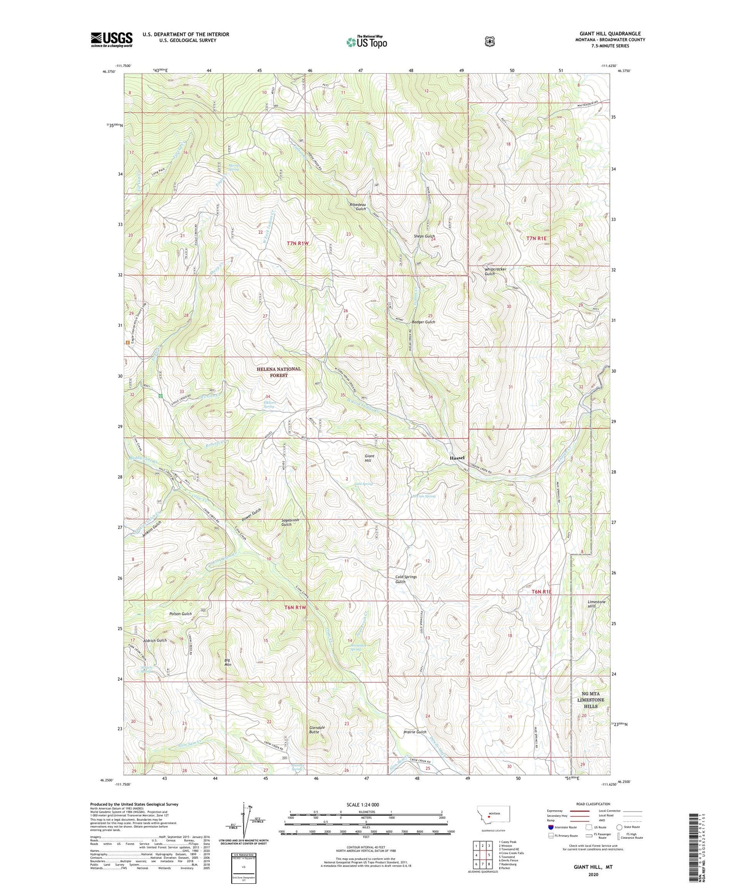
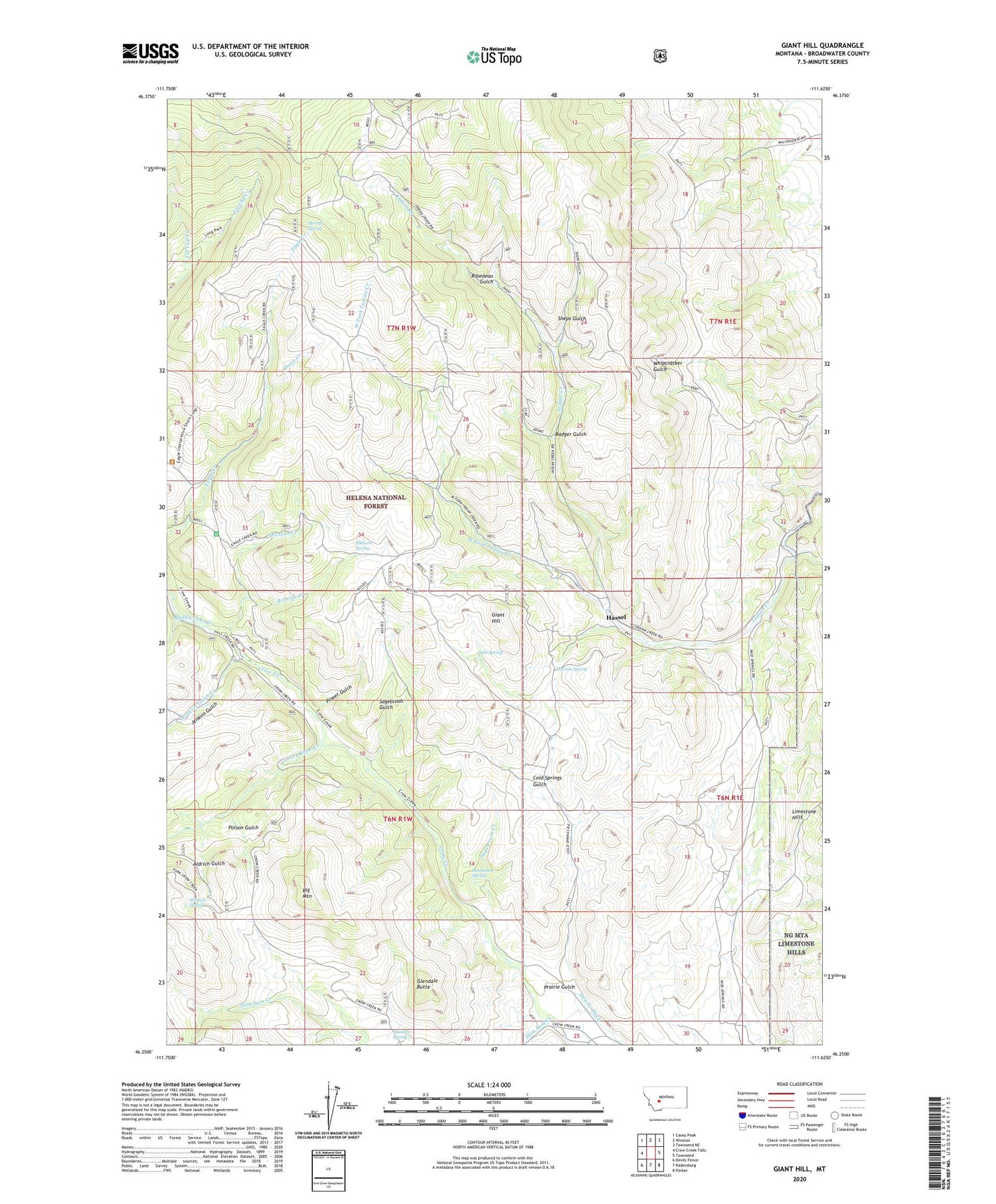
2020 topographic map quadrangle Giant Hill in the state of Montana. Scale: 1:24000. Based on the newly updated USGS 7.5' US Topo map series, this map is in the following counties: Broadwater. The map contains contour data, water features, and other items you are used to seeing on USGS maps, but also has updated roads and other features. This is the next generation of topographic maps. Printed on high-quality waterproof paper with UV fade-resistant inks.
Quads adjacent to this one:
West: Crow Creek Falls
Northwest: Casey Peak
North: Winston
Northeast: Townsend NE
East: Townsend
Southeast: Parker
South: Radersburg
Southwest: Devils Fence
Contains the following named places: Ada Mine, Aldrich Gulch, Aldrich Spring, Badger Gulch, Badger Gulch Mine, BC Number 2 Mine, Big Mountain, Bluebird Mine, Buckeye Mine, Bullion King Mine, Central Mine, Cold Spring, Cold Springs Gulch, Crass Mine, Diamond Hill Mine, Dolcoath Mine, Eagle Creek Ranger Station, Elkhorn Spring, Giant Hill, Glendale Butte, Gold Bug Mine, Hassel, Hassel Post Office, Hassel School, Horseshoe Spring, Hunters Spring, Iron Mask Mine, Jenkins Gulch, Jenkins Gulch Creek, John L Mine, Little Annie Mine, Little Giant Mine, Mamouth Mine, Mason Post Office, McCuin Spring, McMullan, Merritt Spring, Muddy Lake Creek, NE NE Section 14 Mine, NE NE Section 35 Mine, NE NW Section 6 Mine, NW SW Section 6 Mine, Park Mines, Park/New Era Mine, Parker Mine, Phoenix Mine, Polson Gulch, Power Gulch, Prairie Gulch, Queen Bee Mine, Ribedeau Gulch, Ribedeau Mine, Roberts Creek, S and S Mine, Sagebrush Creek, Sagebrush Gulch, Saint Louis Mine, SE SE Section 7 Mine, Sheep Creek, Shep Mine, Sheps Gulch, Slim Sam Creek, South Fork Crow Creek, Spring Hill Mine, SW NE Section 27 Mine, SW NW Section 13 Mine, Tin Cup Creek, Vulture Mine, W A Clark Mine, West Fork Indian Creek, Weston Creek, Whipcracker Gulch