MyTopo
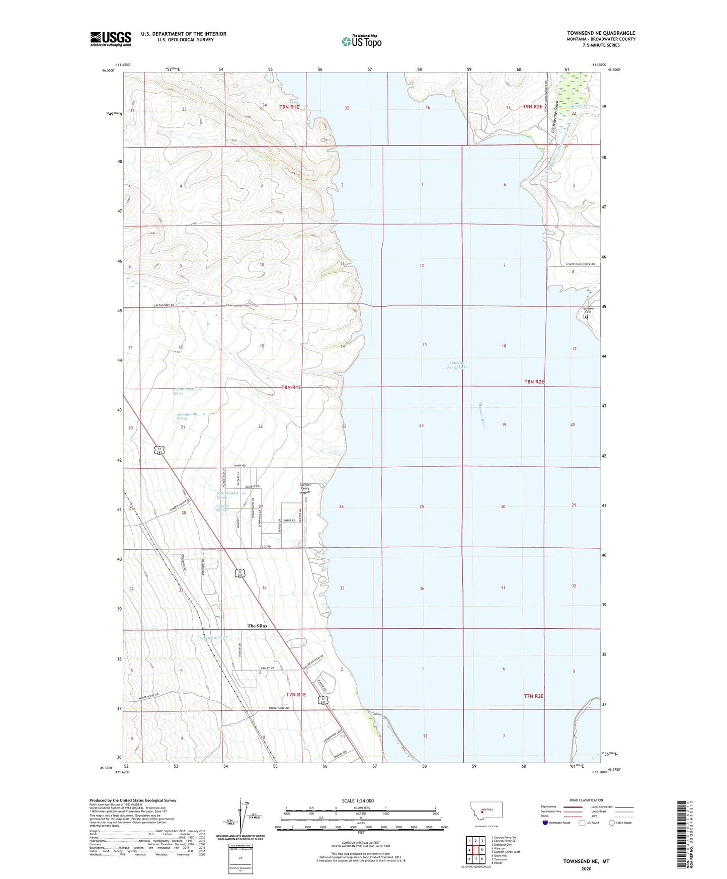
Townsend NE Montana US Topo Map
Couldn't load pickup availability
2024 topographic map quadrangle Townsend NE in the state of Montana. Scale: 1:24000. Based on the newly updated USGS 7.5' US Topo map series, this map is in the following counties: Broadwater. The map contains contour data, water features, and other items you are used to seeing on USGS maps, but also has updated roads and other features. This is the next generation of topographic maps. Printed on high-quality waterproof paper with UV fade-resistant inks.
Quads adjacent to this one:
West: Winston
Northwest: Canyon Ferry SW
North: Canyon Ferry SE
Northeast: Diamond City
East: Gurnett Creek West
Southeast: Holker
South: Townsend
Southwest: Giant Hill
This map covers the same area as the classic USGS quad with code o46111d5.
Contains the following named places: 07N01E03CDDD01 Well, 07N01E03CDDD02 Well, 07N02E05AB__01 Well, 07N02E05AB__02 Well, 07N02E05AB__03 Well, 07N02E05BD__01 Well, 07N02E05BD__02 Well, 07N02E05BD__03 Well, 07N02E05BD__04 Well, 07N02E05CD__01 Well, 07N02E05CD__02 Well, 07N02E05DC__01 Well, 07N02E05DC__02 Well, 07N02E06DA__01 Well, 07N02E06DA__02 Well, 08N01E21BA__01 Spring, 08N01E21BD__01 Spring, 08N01E28AD__01 Spring, 08N02E06AC__01 Well, 08N02E06DB__01 Well, 08N02E06DB__02 Well, 08N02E07AA__01 Well, 08N02E07AA__02 Well, 08N02E08CA__01 Well, 08N02E17BB__01 Well, 08N02E18AD__01 Well, 08N02E20CD__01 Well, 08N02E20CD__02 Well, 08N02E29BD__01 Well, 08N02E29DC__01 Well, 08N02E29DC__02 Well, 08N02E30CC__01 Well, 08N02E32BA__01 Well, 08N02E32BA__02 Well, 08N02E32BA__03 Well, 08N02E32CD__01 Well, 08N02E32CD__02 Well, 08N02E32DB__01 Well, 08N02E32DB__02 Well, 09N01E34AA__01 Well, 09N01E35CB__01 Well, 09N01E35CB__02 Well, 09N01E36DA__01 Well, 09N01E36DA__02 Well, 09N02E31DA__01 Well, Antelope Springs, Canton, Canton Post Office, Canyon Ferry Airport, Canyon Ferry Lake, Clow, Confederate Gulch, Congdon Creek, Duck Creek, Fairview Cemetery, Horse Creek, Magnolia Post Office, Silos Campground, Silos Recreation Area, Silos RV Park, Thars Gold in Them Thar Hills Historical Marker, The Silos Census Designated Place, Whitehorse Creek