MyTopo
Gird Point Montana US Topo Map
Couldn't load pickup availability
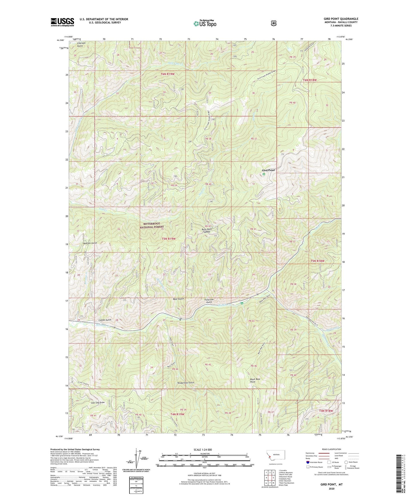
2020 topographic map quadrangle Gird Point in the state of Montana. Scale: 1:24000. Based on the newly updated USGS 7.5' US Topo map series, this map is in the following counties: Ravalli. The map contains contour data, water features, and other items you are used to seeing on USGS maps, but also has updated roads and other features. This is the next generation of topographic maps. Printed on high-quality waterproof paper with UV fade-resistant inks.
Quads adjacent to this one:
West: Mountain House
Northwest: Corvallis
North: Willow Mountain
Northeast: Burnt Fork Lake
East: Skalkaho Pass
Southeast: Kent Peak
South: Bald Top Mountain
Southwest: Deer Mountain
Contains the following named places: 05N19W26BC__01 Well, Bear Gulch, Black Bear Campground, Black Bear Forest Service Station, Black Bear Point, Brennan Creek, Buck Horn Saddle, Coffee Gulch, Daly Creek, Fullerton Gulch, Gird Point, McCurtney Creek, Railroad Creek, Tenderfoot Gulch, Yellowstone Camp