MyTopo
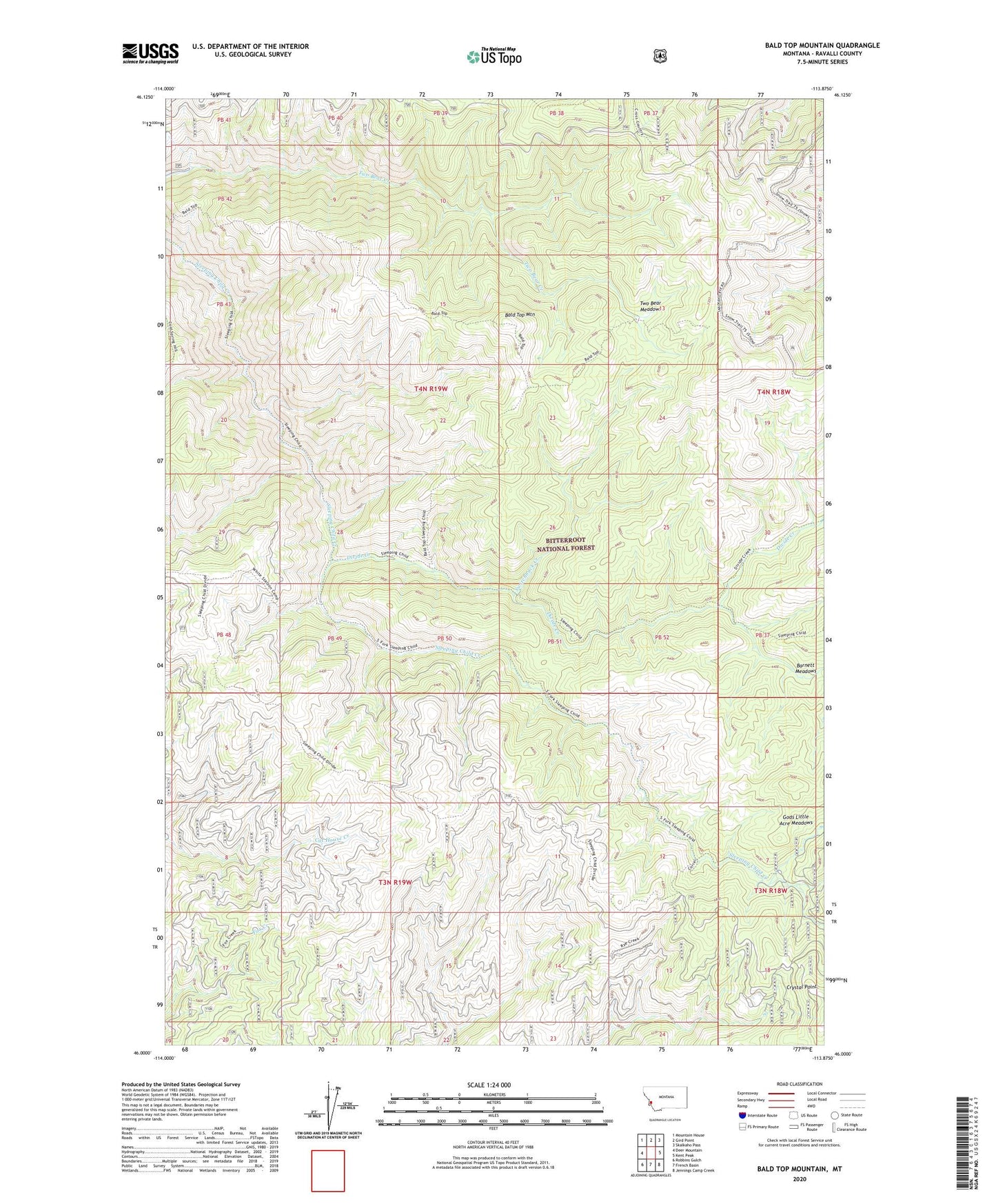
Bald Top Mountain Montana US Topo Map
Couldn't load pickup availability
Also explore the Bald Top Mountain Forest Service Topo of this same quad for updated USFS data
2024 topographic map quadrangle Bald Top Mountain in the state of Montana. Scale: 1:24000. Based on the newly updated USGS 7.5' US Topo map series, this map is in the following counties: Ravalli. The map contains contour data, water features, and other items you are used to seeing on USGS maps, but also has updated roads and other features. This is the next generation of topographic maps. Printed on high-quality waterproof paper with UV fade-resistant inks.
Quads adjacent to this one:
West: Deer Mountain
Northwest: Mountain House
North: Gird Point
Northeast: Skalkaho Pass
East: Kent Peak
Southeast: Jennings Camp Creek
South: French Basin
Southwest: Robbins Gulch
This map covers the same area as the classic USGS quad with code o46113a8.
Contains the following named places: Bad News Camp, Bald Top Mountain, Barnett Meadows, Crystal Mountain Mine, Crystal Point, Divide Creek, SW SE Section 15 Mine, Switchback Creek, Two Bear Meadows, White Stallion Camp