MyTopo
Glasgow Montana US Topo Map
Couldn't load pickup availability
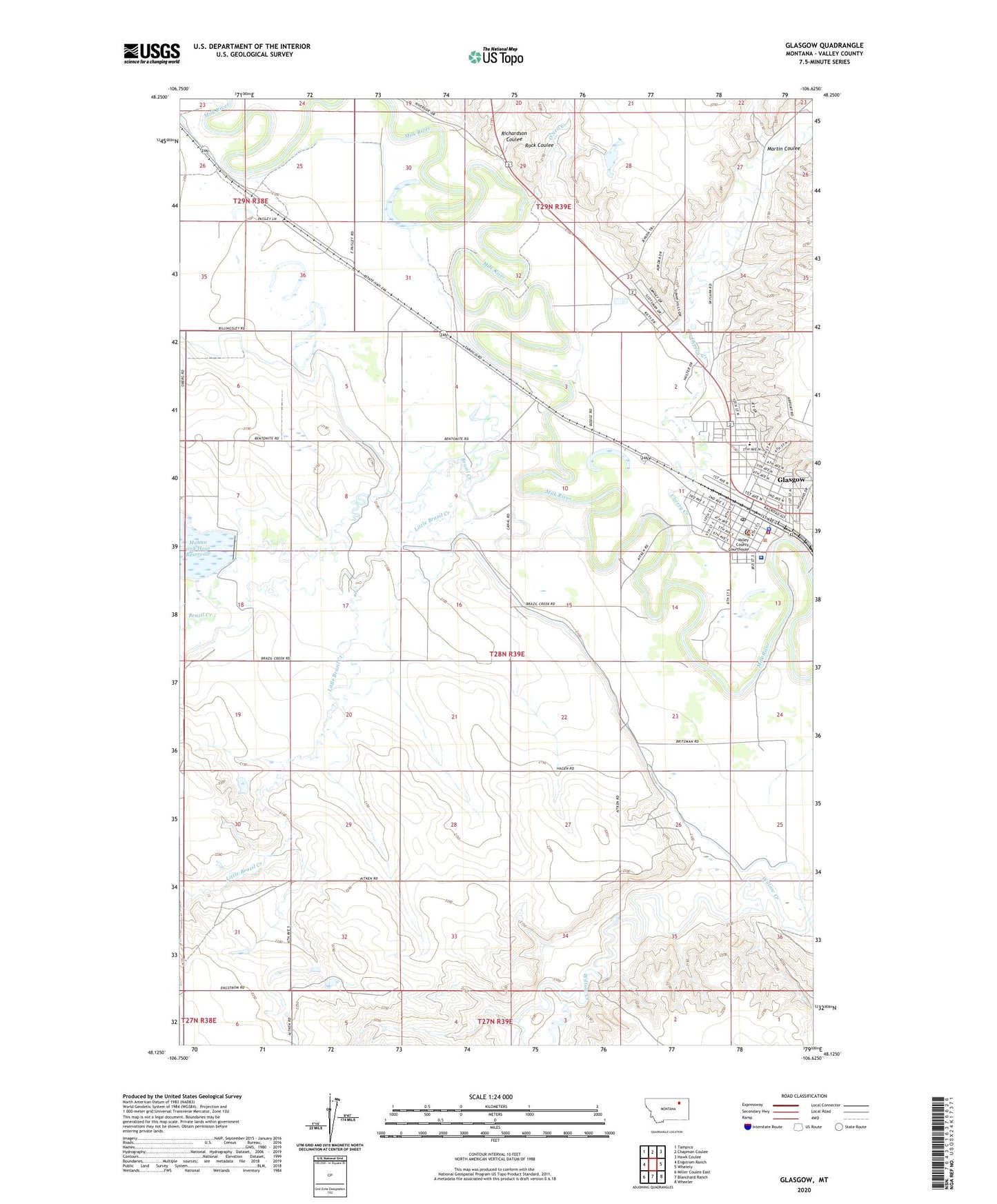
2024 topographic map quadrangle Glasgow in the state of Montana. Scale: 1:24000. Based on the newly updated USGS 7.5' US Topo map series, this map is in the following counties: Valley. The map contains contour data, water features, and other items you are used to seeing on USGS maps, but also has updated roads and other features. This is the next generation of topographic maps. Printed on high-quality waterproof paper with UV fade-resistant inks.
Quads adjacent to this one:
West: Engstrom Ranch
Northwest: Tampico
North: Chapman Coulee
Northeast: Hawk Coulee
East: Whately
Southeast: Wheeler
South: Blanchard Ranch
Southwest: Miller Coulee East
This map covers the same area as the classic USGS quad with code o48106b6.
Contains the following named places: 28N39E08ADCB01 Well, 28N39E11CBDD01 Well, 28N39E14CBAD01 Well, 28N39E20ABCC01 Well, 28N39E20CA__01 Well, 28N39E32CCDD01 Well, 29N39E28DCCC01 Well, Alumni Park, Assembly of God Church, Brazil Creek, Buffalo Country Historical Marker, Bundy Park, Calvary Baptist Church, Candy Cane Park, Central Hospital, Cherry Creek, Church of Christ, Church of the Nazarene, City of Glasgow, Detchman School, Faith Lutheran Church - Missouri Synod, Federal Bureau of Investigation Glasgow Office, First Baptist Church, First Congregational Church United Church of Christ, First Lutheran Church, First United Methodist Church, Frances Mahon Deaconess Hospital, Frances Mahon Deaconess Nursing Home, Gig G Shopping Center, Glasgow, Glasgow City County Library, Glasgow Clinic, Glasgow Family Chiropractic Clinic, Glasgow Police Department, Glasgow Post Office, Glasgow Sewage Lagoon Dam, Glasgow Volunteer Fire Department, Great Northern Hospital, Harvest States Cooperatives Elevator, Hoyt Park, Irle School, Jehovah's Witnesses, KLTZ-AM (Glasgow), Little Brazil Creek, Little Brazil Number 3 Dam, Maham and Hoyt Reservoir Dam, Mahan and Hoyt Reservoir, Martin Coulee, O'Neil Creek, Paisley, Red Rock Plaza Park, Richardson Coulee, Rock Coulee, Saint Matthews Episcopal Church, Saint Raphael School, Saint Raphaels Catholic Church, Scotty Park, Seventh Day Adventist Church, South Side School, Sunnyside Golf Club, Sweet Carolyn Dam, Terrys Drive In, The Church of Jesus Christ of Latter Day Saints, Trails West Campground, Treasure Trail Shopping Center, Valco Agri Services Incorporated Elevator, Valley County Courthouse, Valley County Fairgrounds, Valley County Home, Valley County Pioneer Museum, Valley County Sheriff's Office, Valley View Home, Wokal Field/Glasgow International Airport